Forest Service Road Conditions 2011
©ammy, Tue Apr 26 2011, 09:58PM
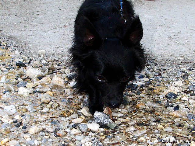
Yesterday as R and I were taking Sirius for his first offroad adventure, I had the idea to start a thread on here to post current conditions of the various Forest Service dirt roads around the Big Bear area. Feel free to share any info y'all find as you drive/bike/hike along these roads including road condition, recently re-opened gates, closed gates, snow on the road, washed out sections of road, and anything else interesting and helpful.
We discovered yesterday that the gates on 3N08 - map: [Click Here] have re-opened for, as far as I know, the first time since the Butler 2 Fire! We checked the gates on both ends of 3N08 (basically located at A & B on the previous map) to confirm that they're both open and they are. But we did not drive the whole length of 3N08, we turned north on 3N89 (Greenlead Road) - map of the route we took: [Click Here] and found that the fence that was across 3N89 at 3N16 is now open as well! (The fence is at B on the previous map.) There is water flowing across 3N08 at Greenlead Creek, and there are a couple more small streams to cross but these pose no challenge as they're not too deep. We did use 4WD a couple of times in our Toyota Tundra as there are a couple of tricky sections that I didn't want to try in 2WD. You'll definitely want a high clearance vehicle for this route (3N08 to 3N89).
Here's a complete map of our trip: [Click Here] We drove along 3N14 to 3N08. 3N14 is a good road that can be driven in 2WD with no problem. After we took 3N08 to 3N89 we ended up on 3N16. This is another good road and we had no trouble navigating it in 2WD. When we got to 3N12, we took it up around the north side of Delamar Mountain back to 3N14. There is one patch of snow on 3N12, but we had no trouble crossing it in 2WD as there are ruts in the snow from other vehicles going through before us. I also took our Jeep Wrangler through there today in 2WD with no trouble. The snow will probably have melted off the road within a week.
Re: Forest Service Road Conditions 2011
Deb Doodah, Tue Apr 26 2011, 10:29PM
I clicked on your first map and it gave me a subdivision off the 60 in Riverside. .
.
We went exploring a bit on Sunday but I am not sure of the road numbers. But we did pass Camp Whittle. That road was fine with a couple of spots with some mud - just enough to make my wheel wells caked with mud.
Re: Forest Service Road Conditions 2011
Mtngoat John⭐, Tue Apr 26 2011, 10:40PM
Deb, you were on 3N14. Don't need to know the road #'s unless there is a problem. Heck BGS never got lost as far as I know.
Re: Forest Service Road Conditions 2011
Deb Doodah, Tue Apr 26 2011, 10:46PM
I don't think there was much chance of getting lost. All the forest roads are on the cars gps which I thought was really cool. Plus we didn't go very far. We aren't as big adventurers as you guys. Yet!
Re: Forest Service Road Conditions 2011
bills grandson, Wed Apr 27 2011, 05:33AM
nope never lost in the woods. Sometimes the place I was looking for might get lost.
I think the hardest thing was learning my way around upper moon ridge.
Cities forget about it. It is almost impossible to get around down here. No straight lines to take you anywhere. I just got a GPS which helps but I am already looking to upgrade. A couple of weeks of rebuilding my dash to get everything right. And now I want to rip it out and start over. New radio with all the bells and whistles you can think of. 300. at walmart. Every other one I have seen like it is 800.
I was thinking the other day that it doesn't seem like that long ago that cars had no seat belts, turn signals, or radio's. Heaters were a luxery, and almost no air conditioning. First cars I bought really didn't have a two foot square place needed for one.
Had to wait for a minute for the tubes to heat up.
Do you even have to learn hand signals anymore to drive a car? And would anyone know what you were doing? Probably get shot for throwing "gang signs".
I think Cammy has a great idea. I have always wanted to get people out to enjoy the beauty most don't even know is all around them. To bad there are so few animals to share it with anymore.
Re: Forest Service Road Conditions 2011
©ammy, Wed Apr 27 2011, 10:28AM
Anyone else have this problem?
Re: Forest Service Road Conditions 2011
Lumber Jill, Wed Apr 27 2011, 10:42AM
Nope...looks like Holcomb Valley to me!
Re: Forest Service Road Conditions 2011
bills grandson, Wed Apr 27 2011, 10:44AM
Cammy I had no problem.
Make sure you write what condition the roads are in and what kind of vehicle you might need. So a street car can be taken on while others need 4WD. And some are not even begginer 4WD As well as any high lights or things to see along the way. I will try to add what things I know or have learned about each stretch also.
Re: Forest Service Road Conditions 2011
©ammy, Wed Apr 27 2011, 10:54AM
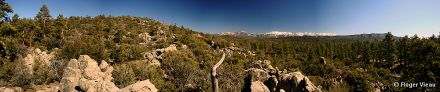
Yesterday's adventures included leaving Fawnskin on 3N14 to 3N12 to 3N16 to 3N32 up 3N10 to the east a little bit, turned around, back down 3N32 to 3N16 to 2N09 to Hwy 38. Here's an incomplete map, as 3N32 doesn't show up on Google Maps: [Click Here] 3N32 goes to the north from 3N16 at B on this map: [Click Here] but 3N32 is not Burnt Flat Road. That road doesn't actually exist as it's been fenced off some time ago.
Anyway, to the road conditions: we covered the portions of 3N14 & 3N12 in the first post. 3N16 between 3N12 & 3N32 - map: [Click Here] is in good shape - it was resurfaced with that gravel/sand mix a year or so ago, so passenger cars would have no trouble navigating this section. 3N32 is a road that a high clearance vehicle would be good to use as there are a lot of deep ruts in this road. I didn't need to use 4WD on this road at all, but the high clearance was helpful. There was a mud puddle about 1/4 mile in on the road that could be bypassed but that's no fun! There is also a small stream crossing on this road, but the water is shallow and no problem to cross. The north end of 3N32 is where it intersects 3N10. I went east on 3N10 for maybe a half mile before I decided it would be better to not get the Jeep stuck on the rocks so I turned around. I did use 4WD a couple of times on 3N10. After I turned around, I went back on 3N32 to 3N16 to 2N09. I took 2N09 back to Highway 38 - map: [Click Here]. This is another road that was resurfaced a year or so ago, and while it is a bumpy ride in some spots, I think it could be navigated with a passenger car as long as you go slow.
The gate on the north end of Van Dusen Canyon Road (3N09) is still closed - A on this map: [Click Here] so I assume the gate at the south end of this road is still closed as well - B on previous map. Also, the gate at 3N12 & 2N84 - A on this map: [Click Here] has been closed since the Butler 2 Fire and as of yesterday is still closed.
I'll check the gates on both ends of 2N93 today (Wildhorse Meadows Road) but I'd be really surprised if they're open as there's still a good amount of snow on the north side of Sugarloaf Mountain.
Re: Forest Service Road Conditions 2011
©ammy, Wed Apr 27 2011, 10:56AM
Here are some videos from yesterday. The first 2 videos are sped up about 5x. The last one is at real time speed.
3N12
3N16 from 3N12 to 3N32
3N32 Mud Puddle!
Re: Forest Service Road Conditions 2011
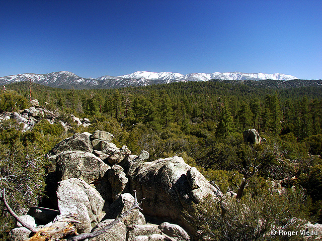
©ammy, Wed Apr 27 2011, 11:06AM
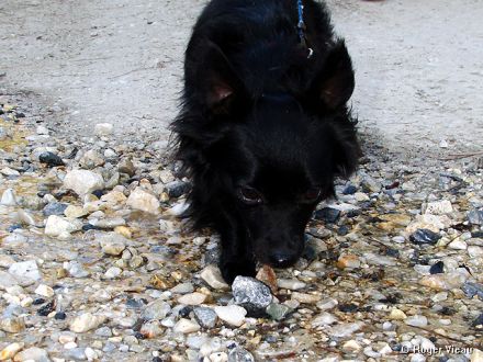
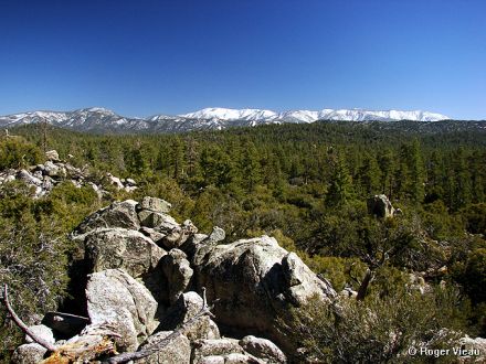
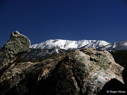
Here are a couple pictures from the past 2 days' adventures. More to come but I'm off now to go be "Where In So Cal Is Cammy San Diego".
Sirius Explorer
View from a ways off the road - 3N32
Re: Forest Service Road Conditions 2011
Lumber Jill, Wed Apr 27 2011, 11:06AM
Damn you drive fast when I'm not around!
Re: Forest Service Road Conditions 2011
bills grandson, Wed Apr 27 2011, 11:41AM
Cool video. Forest looks great 3x time would have been the way I like to roll sometimes.
I guess I will have to start learning the numbers for the roads
Re: Forest Service Road Conditions 2011
©ammy, Wed Apr 27 2011, 05:28PM
2N93 still hasn't opened for the season yet. Also, the gate on 2N13 at 3N14 is still closed. 2N13 is the road to get to Butler Peak.
Re: Forest Service Road Conditions 2011
©ammy, Fri Apr 29 2011, 09:09PM
Re: Forest Service Road Conditions 2011
Juliann, Fri Apr 29 2011, 09:34PM
Have you heard if the public will be allowed to drive to Butler Peak this summer?
Re: Forest Service Road Conditions 2011
©ammy, Fri Apr 29 2011, 09:42PM
I have not heard either way. I'll let y'all know on here once they reopen it.
Re: Forest Service Road Conditions 2011
©ammy, Sun May 01 2011, 07:42PM
Update from yesterday - The snow patch is barely noticeable on 3N12, in fact we saw a small Honda car (Civic, I think) that I have to assume passed over the snow patch unless they drove up & turned around before it.
We completed the eastern section of 3N08 - map: [Click Here]. 4WD is a must for this part of the road as there is a steep, rocky section of the road.
3N14 from 3N08 to Big Pine Flat is in great shape and I believe a passenger car would have no trouble making it from Fawnskin to Big Pine Flat on this route - map: [Click Here]
From Big Pine Flat you can head East on 3N16 which is supposed to be a good road (green rating, I believe). But there is a section just east of Big Pine Flat that had seen much erosion in the past few years. We did not need 4WD for any of this road yesterday. We went all the way to 2N09 - map: [Click Here] but the higher clearance of the Tundra was nice to have. There was one spot where I tried to cross a rutted section on the road and ended up having only my left front and right rear wheels on the ground! I had to back up and approach the rut from a different angle to get through.
3N97 - map: [Click Here] and 3N04Y - map: [Click Here] have been closed, I believe, since the Butler 2 Fire. They still have closed gates at the A & B markers on the previous 2 map links.
Re: Forest Service Road Conditions 2011
Lumber Jill, Sun May 01 2011, 07:57PM
A change of underwear is helpful, also
Re: Forest Service Road Conditions 2011
©ammy, Sun May 01 2011, 08:18PM
Oops! Sorry 'bout that!
Re: Forest Service Road Conditions 2011
©ammy, Tue May 03 2011, 04:58PM
Today's short adventure was on roads 2N09, 2N71, 3N12 & 3N14. 2N71 is the only road I haven't recently covered. This road is in good shape and I'd think a passenger car could handle this road except it may have trouble with one spot near the west end of the road where a stream eroded a deep channel across the road. It's deep enough that I basically came to a stop with my front wheels in the channel and then proceeded to give the Jeep some gas to move through the channel.
[Click Here] for a Google Map with my GPS track on these roads.
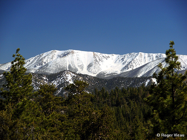
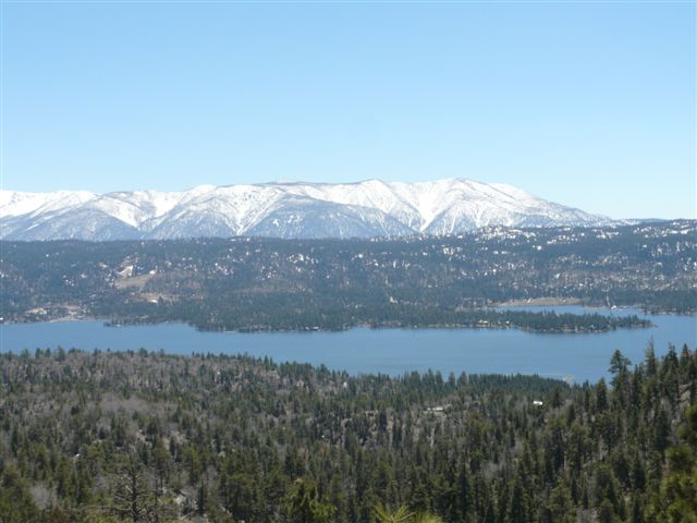
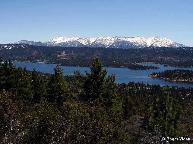
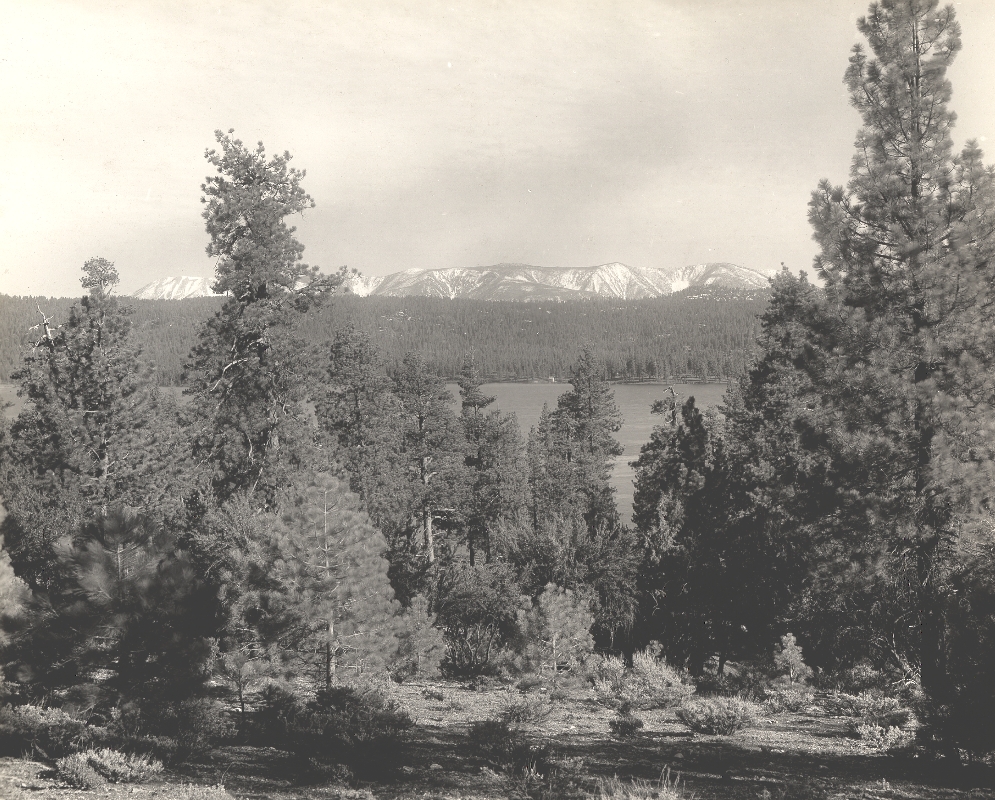
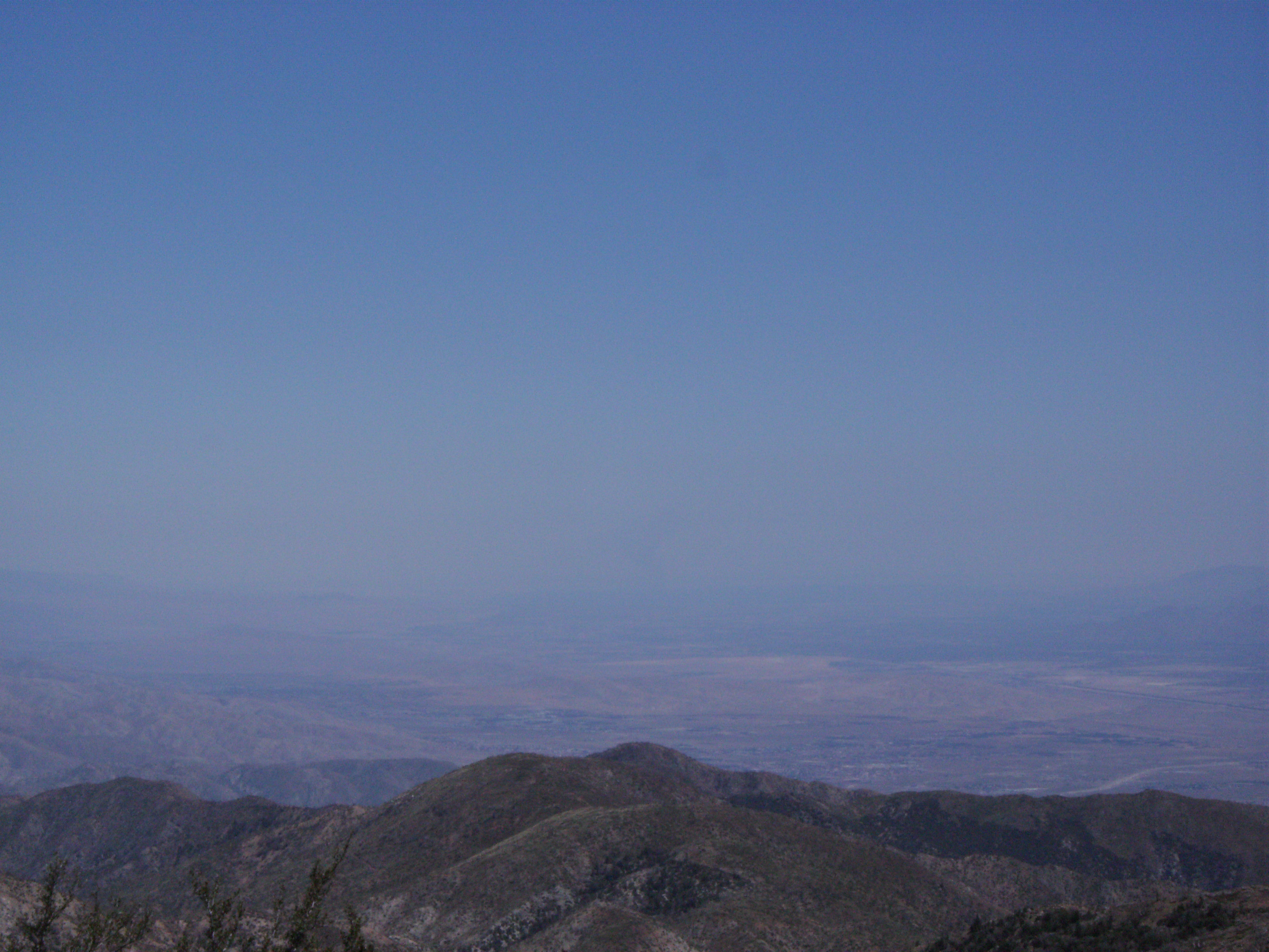
Here's a video I took of 2N71, including a stop with a fantastic view overlooking Big Bear Lake and the snow covered peaks of the San Gorgonio Wilderness:
Re: Forest Service Road Conditions 2011
Mtngoat John⭐, Tue May 03 2011, 06:10PM
From 4-22 looks like a lot of snow has melted on San G since then. Popular spot to take a photo

Re: Forest Service Road Conditions 2011
©ammy, Tue May 03 2011, 07:07PM
Well what a surprise! I do have a photo from there today!
Re: Forest Service Road Conditions 2011
Lumber Jill, Tue May 03 2011, 07:56PM
The question is how many hundreds of photos do you have from that spot?
Re: Forest Service Road Conditions 2011
©ammy, Tue May 03 2011, 08:01PM
Probably multiple hundreds!
Re: Forest Service Road Conditions 2011
Deb Doodah, Tue May 03 2011, 08:05PM
I think we have pictures from that spot too!
Re: Forest Service Road Conditions 2011
bills grandson, Tue May 03 2011, 08:28PM
When they improved that road from a jeep trail that became a very familiar picture. Even 90 years ago the view was captured. This from a bit lower.
Great to see the video the trees look so much better then a few years ago.

Re: Forest Service Road Conditions 2011
©ammy, Tue May 03 2011, 08:32PM
Based on the snow in what's now the San Gorgonio Wilderness, that picture looks like it's from about the same time of year.
Re: Forest Service Road Conditions 2011
bills grandson, Wed May 04 2011, 05:03AM
That is one of the many a friend sent. I think all are posted in the photo's section. I sent that in high res and if you download it and blow it up there is a huge building along the lake I have no idea what it is. I think the picture was take in the late 1910's. I know it sounds very old man but even I can remember wgen there was still a lot o snow on San G as late as July. But Spring is the best time to get pictures.
I think I have one that I took from the same spot when they first upgraded that road.
Re: Forest Service Road Conditions 2011
Mtngoat John⭐, Wed May 04 2011, 06:03AM
Funny, I went through and looked I have quite a few from up there. Definately a great spot to take photos.
BG great old photo! Love seeing the difference in the trees and the area. Thanks
Re: Forest Service Road Conditions 2011
bills grandson, Wed May 04 2011, 07:11AM
There are a bunch of them. Very high quality. Came from a member who passed them on through me. They were used to make many of the old post cards.
What would be fun is to set up a camera at that spot that would be motion activated just to see how many people stop and take a picture within those few hundred feet. Views looking down on the lake from several points, and anything showing majestic views of San G have got to be the most popular and this one has both features.
Re: Forest Service Road Conditions 2011
©ammy, Fri May 06 2011, 09:16PM
Don't go on 3N02. That road wants to eat you! R can tell you more.
Re: Forest Service Road Conditions 2011
melvin, Sat May 07 2011, 02:10PM
the road to hart bar and the yellow post sites is open.. you cant get up to the aspen grove yet
Re: Forest Service Road Conditions 2011
©ammy, Sat May 07 2011, 07:05PM
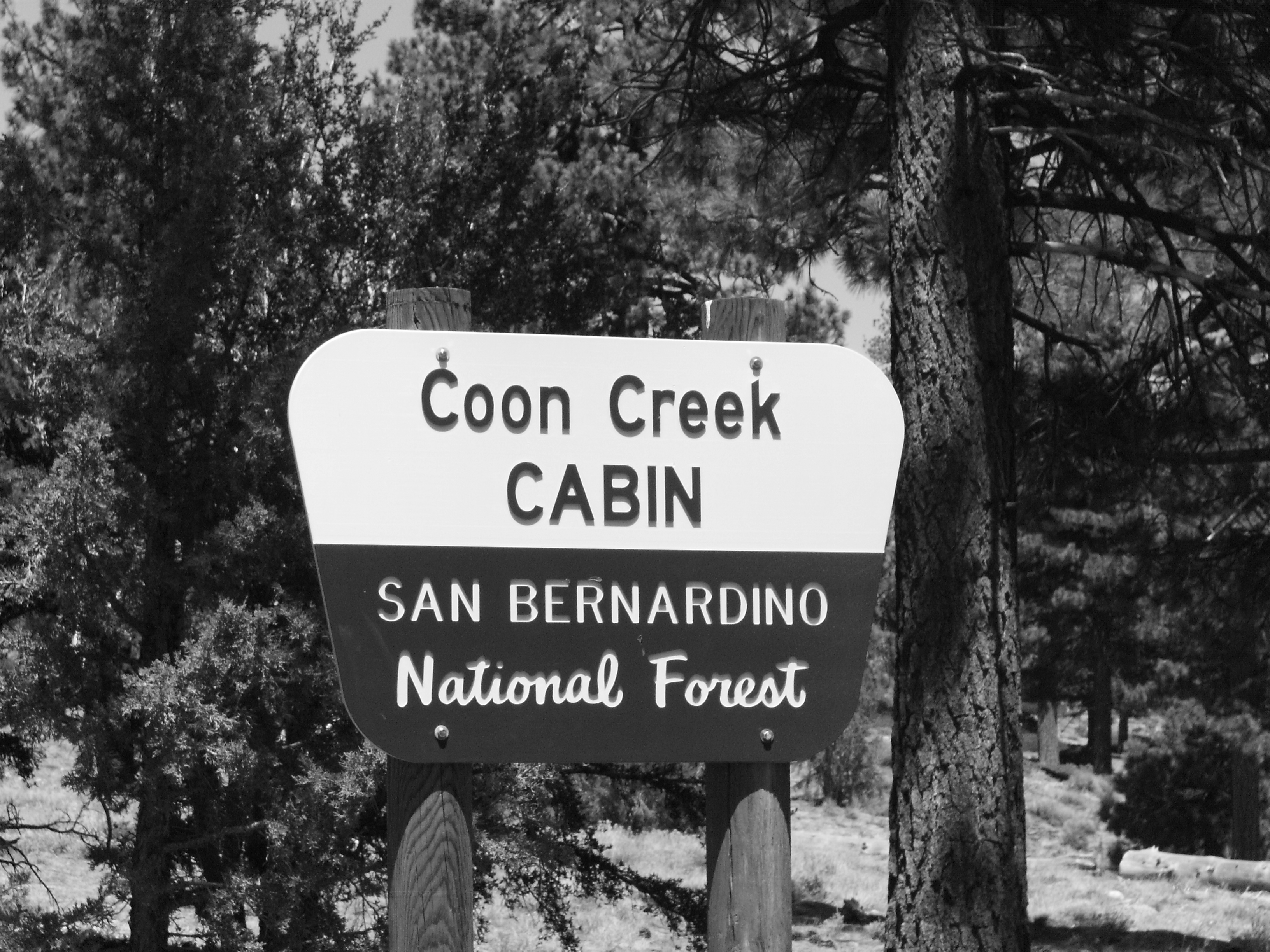
Thanks for the info, Mel! If I'm understanding you correctly, 1N02 is open - map: [Click Here] (I believe that east of marker B on the previous map is private property and there is a gate across 1N02.) Mel - did you take 1N02 from Highway 38, past the yellow post sites all the way up to the Coon Creek Cabin?
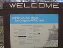
1N05 - map: [Click Here] past the parking area for the Aspen Grove, and up to the Fish Creek Trailhead, is still not open for the season.
Re: Forest Service Road Conditions 2011
©ammy, Sat May 07 2011, 07:15PM
Since R is apparently still too traumatized by the incident yesterday, I'll explain. I got the truck stuck in a big, mud-filled rut on this road. But a few minutes of digging with the shovel we keep in the truck for this exact reason and we were freeeeeee!
Additionally from yesterday - all the snow has now melted off of the road on 3N12. 3N05 around Holcomb Valley Campground is in decent shape, but low-clearance vehicles could have trouble if you're not careful. 3N07 - farther north from the Holcomb Valley campground is in fine shape until about 1/4 mile from the east end of this road, there's a creek crossing with water covering the whole road which is pretty sandy in this area. I decided against giving the truck a mud bath here, not wanting to risk getting stuck for a second time in the same trip.
Re: Forest Service Road Conditions 2011
Lumber Jill, Sat May 07 2011, 07:29PM
not traumatized at all...i knew you'd dig us out! with an emphasis on YOU <3
<3
Re: Forest Service Road Conditions 2011
bills grandson, Sat May 07 2011, 08:06PM
Cammy
If you don't have a winch look into buying a wagon jack. One of the tall heavy ones. I think the trade name is hi-jacker They are great and can be used as a winch at times. Also some plywood in case it is really muddy.
Also take 2 shovels.
".....there ain't no free ride"
Re: Forest Service Road Conditions 2011
Lumber Jill, Sat May 07 2011, 08:19PM
hey! i didn't get us stuck! in reality i was feeling pretty crappy and he was a sweetie for not hoping i'd get out and help.
Re: Forest Service Road Conditions 2011
bills grandson, Sat May 07 2011, 08:30PM
Just kidding
besides your not married yet so you get a pass.
Re: Forest Service Road Conditions 2011
Lumber Jill, Sat May 07 2011, 08:34PM
ahahaha
Re: Forest Service Road Conditions 2011
©ammy, Sat May 07 2011, 08:44PM
Other than the mud puddles that I enjoy splashing through, I'm really not trying to do anything crazy in the truck. And I will turn around if a mud puddle looks like it can get me. I also stay away from the overly rocky sections in particular. Funny thing about yesterday's adventure is that I made it over this section of road just fine the first time. It was coming back that got me. I just wasn't completely paying attention to my route when straddling the deep ruts and I got into the wrong spot. Normally, I stay clear of anything even remotely as bad as this, but I was being stubborn yesterday.
And ya, I got us stuck so I was going to get us out. I didn't expect R to help me out. I'm stubborn that way too!
Re: Forest Service Road Conditions 2011
melvin, Sun May 08 2011, 03:47AM
i did not go all the way to the cabin but i saw a forest service truck coming from that direction.. i went to the right at the 2nd fork to the other yellow post sites and the ca biking and hiking trail..
Re: Forest Service Road Conditions 2011
melvin, Sun May 08 2011, 03:50AM
and yes past the cabin there is a fince going across the rd.. ive always been tempted to go anyway to see whats there
Re: Forest Service Road Conditions 2011
bills grandson, Sun May 08 2011, 07:34AM
The story of that area is very interesting as told to me by my mother.
It was owned by a Big Bear local J.B, Quail (spelling? probably Quayl)
It was at least one section, possibly more of school, or R.R.land. There are several in that area privetly owned. When he purchased the land he sold timber which covered the cost of the land. Heart bar was donated for tax purpoes. There is another home beyond the fence. As far as I know till owned by the family. When they were looking for a site for bouncing T.V. tinto Yucca valley they leased property from him for their tower. So part of that deal was the home has power from their generator, and T.V.
pretty sharp Don't ask me how they get fuel up there
I have never been past the gate either but google earth show a lot of roads back in that area that I never had a clue about.
PCT crosses right at the cabin and I once met an older man who was hiking the entire trail. He did it in sections being let off at one place then picked up at the next by his wife. Then next time he was up to it he would do another.
Re: Forest Service Road Conditions 2011
Mtngoat John⭐, Sun May 08 2011, 08:22AM
I have been past the gate. Maybe a quarter to a half mile past the house there. Decided not to go further as I was alone and was getting an eerie feeling like I was being watched.
About a week later I was informed by a law enforcement friend in Shay Meadows that I should not be “snooping around down there”. He would not expand on that info, but in the context of our conversation I knew exactly what he meant.
Re: Forest Service Road Conditions 2011
bills grandson, Sun May 08 2011, 08:47AM
Strange
I always try to respect private property. Not so much fences on public land.
I was looking at google and saw the second house not far from the first. And by the looks of the roads it looks like some may at one time go clear to the Yucca valley area. Also you can see what I take was the onyx mines I have heard about between there and pipes canyon. That did have a road to the desert but I think was washed out long ago. Much more in there then I knew about. Rough country.
A very long time ago a friend had told me that there was a missle site put in during the cold war. He had indicated it was in Jacoby canyon. Turns out that was B.S. but there is one near Wrightwood. Could there be one there also?
Re: Forest Service Road Conditions 2011
©ammy, Mon May 09 2011, 09:24PM
We noticed that the gates to 2N93/Wildhorse Meadows Road opened yesterday - map: [Click Here] so we went for a drive up there today. The road weathered the winter rather well! I drove this road in a small car (Mercury Topaz) ~ 7 years ago with no problem, and I think it would be possible to do it again in a passenger car, but I'd recommend doing it from south to north as there's a section less than a mile in on the south side that might be challenging for low-clearance vehicles. We did not use 4WD in the Tundra at all on this road. Also, the snow is all gone from the road.
After 2N93, I had the idea to get back to Fawnskin on dirt roads as much as we could. So we made the quick drive up Hwy 38 over Onyx Summit to 2N01 - map: [Click Here] which is also in very good shape and I believe could be traveled on with a passenger car. We did not use 4WD on this road either.
When we got to the north end of 2N01, we turned left onto 2N02/Burns Canyon Road - map: [Click Here] which R and I both concluded would not be passable in a passenger car. R visually and verbally concluded this, while I used the underside of the truck and a large rock in the road to make my conclusion. This was just east of the Arrastre Creek crossing. I did put the truck in 4WD to cross Arrastre Creek as the water is rather deep here (maybe up to the bottom of the doors in the Tundra?) and I didn't care to take any chances getting stuck.
Lastly, we took 3N16 west from near the dump to 3N12 to 3N14. I've previously covered all of these roads except for the eastern portion of 3N16, but it's not really any different than the rest of it although you'd want to carefully choose your route on this road between the dump and Doble Mine if you were in a low-clearance vehicle.
Here's a GPS track/map of our adventure today: [Click Here]
Additionally, we noticed that the north gate on 3N09/Van Dusen Canyon Road is open so I'm assuming the south gate is now open as well. Here's a map of this road: [Click Here]
Re: Forest Service Road Conditions 2011
bills grandson, Mon May 09 2011, 09:48PM
The South part of the Wildhorse road is usually rocky. While the North part to the top is not to bad. If you are new at off road I would start with that. Van Dusen is always my favorite into Holcomb. Ten minutes and your in the middle of the place. I really hope those who have not gotten out in the woods find time this year. Many of the roads are not bad at all. And almost all can be done after you have a little expirence. In Holcomb you can stop anywhere and find history within fifty feet of the road.
Lots of stuff on the history is out there and it is fun to learn about it. Some of the better known ones don't pan out and every mining town has it's version of the same story. The forest service even faked at least one.
Re: Forest Service Road Conditions 2011
©ammy, Tue May 10 2011, 07:27PM
Here are a couple videos from today. The first is 3N09/Van Dusen Canyon Road, going up from Big Bear City into Holcomb Valley. The second is 2N09/Polique Canyon Road from Holcomb Valley back to Highway 38.
Re: Forest Service Road Conditions 2011
©ammy, Tue May 10 2011, 07:39PM
3N09/Van Dusen Canyon Road - map: [Click Here] recently opened for the season, so I drove it today. The road is in great shape and I believe a low-clearance vehicle would have no trouble with this road.
Continuing on my adventure today, I went to check out some roads I hadn't been on in a while. I took 3N10 from 3N16 to 3N43, went down 3N43 to 3N23, took that road across to 3N83 which I followed to 3N16. From 3N16 I headed east to 3N82 which goes back up to 3N83, which I took back to 3N10. These roads aren't shown in Google Maps, but all do appear on topo maps. All of these roads except for 3N16 are definitely for high clearance, 4 wheel drive vehicles only. These roads are also quite narrow. We've driven them all in our 4 door Tundra before, but ended up with some "forest pin striping". Even in the Jeep Wrangler today, there were some narrow sections that I just barely squeezed through.
Here's my GPS track from today: [Click Here]
Re: Forest Service Road Conditions 2011
bills grandson, Tue May 10 2011, 10:05PM
Van Dusen is my all time favorite. I think you could get a lo-rider up it except right below the resivor. But it is a little tight in places for oncoming traffic.
next time up at about 1:10 while going through the cut look across through the trees. There is a strange rock formation we called the hulks hand. Loofs like a fist and arm sticking up about 30 feet tall. really out of place. Kind of hard to find. I think rock climbers might climb it. I was trying to find the two cabins so I could give you a google earth shot but It is hard to find things there sometimes So I will find another way. They are off of the Union flats road at the last place you can turn left before it turns to John bull flats. On the road that goes under the rock There are several fun things in that area including my old gold mining favorite
Re: Forest Service Road Conditions 2011
melvin, Thu May 12 2011, 03:33PM
yes!!

Re: Forest Service Road Conditions 2011
©ammy, Thu May 12 2011, 09:26PM
You went back! Sneaky!
How's the road? No problem in your truck?
Re: Forest Service Road Conditions 2011
melvin, Thu May 12 2011, 09:30PM
yes i went back today and hiked up the hiking and riding trail for a bit then went to the cabin.. the road has the same old bumps and grinds but is in good condition
Re: Forest Service Road Conditions 2011
melvin, Thu May 12 2011, 09:30PM
and no probs in my truck
Re: Forest Service Road Conditions 2011
©ammy, Thu May 12 2011, 09:32PM
Cool! Thanks for the info!
Another trip we gotta make at some point this summer!
Re: Forest Service Road Conditions 2011
©ammy, Tue May 17 2011, 07:05PM
We took 2N02 out to Pioneertown and back on Sunday - map of the dirt portion of this route: [Click Here]
We used 4WD in 3 places on the road - the Arrastre Creek crossing, as the water there is really deep, and we kept the truck in 4WD just after the creek as the road has some big rocks in it. We used 4WD again a while later for a steep, rocky, uphill section that we came down last week in the other direction in 2WD with no problem. The 3rd spot we used 4WD was at the east end of Burns Canyon, just before you get to a paved road, as the last part of the road is basically in a sandy wash. I didn't want to find out how stuck we could get if we stopped here or didn't use 4WD so we played it safe. Other than that, the road is in great shape! On the way back, we took 2N01 - between B & C on this map: [Click Here] and by doing so, avoided 2 of the sections we used 4WD in - the Arrastre Creek crossing and the steep, rocky, uphill (which would be downhill on the way back) section.
Re: Forest Service Road Conditions 2011
Craig ⭐, Tue May 17 2011, 07:54PM
We also ate at Pappy and Harriets in Pioneertown, and I can say thay have DELICIOUS burgers!
Re: Forest Service Road Conditions 2011
bills grandson, Tue May 17 2011, 10:05PM
that entire road used to be a very pleasant almost paved type drive. that last time I drove it it was not a lot of fun beyond rose mine. but again a lot of history on the drive.
Re: Forest Service Road Conditions 2011
, Tue May 17 2011, 10:51PM
Hansberger tried to get it paved. He owns land on it.
Re: Forest Service Road Conditions 2011
bills grandson, Tue May 17 2011, 11:36PM
that was probably to make it easier to get to the casino at rose mine.
I wanted to buy some property once in burns canyon. It was very cheap at the time and about as far from the beaten path as you could get.
Re: Forest Service Road Conditions 2011
melvin, Wed May 18 2011, 01:45PM
its not really a forest rd but meadows edge is open now!!
Re: Forest Service Road Conditions 2011
©ammy, Wed May 18 2011, 08:09PM
Oh cool! I just discovered that spot last year, and I like it!
Re: Forest Service Road Conditions 2011
melvin, Thu May 19 2011, 04:29PM
its open!!
Re: Forest Service Road Conditions 2011
bills grandson, Thu May 19 2011, 06:00PM
all right I had to go to triple A today to update my registration and I got a map so now maybe I can speak toad numbers and translate to something I understand.
I will try to put together a map with the numbers, and their names, and the names of spots along the way
Re: Forest Service Road Conditions 2011
Deb Doodah, Thu May 19 2011, 07:22PM
Toads have numbers? Cool.
Sorry just couldn't resist.
Re: Forest Service Road Conditions 2011
bills grandson, Thu May 19 2011, 07:51PM
you got me.
not hard to do.
I wont fix it or nobody would get it
Re: Forest Service Road Conditions 2011
©ammy, Thu May 19 2011, 09:37PM
Sweet! Thanks for the info!
Re: Forest Service Road Conditions 2011
©ammy, Fri May 20 2011, 12:00PM
If I heard my scanner right, it sounds like the Forest Service is in the process of opening the gates on 2N10 & 2N08!
Re: Forest Service Road Conditions 2011
Craig ⭐, Fri May 20 2011, 01:05PM
I heard the same thing Cammy!!
Re: Forest Service Road Conditions 2011
Lumber Jill, Fri May 20 2011, 02:55PM
Yup! 2N10 is open!
Re: Forest Service Road Conditions 2011
melvin, Fri May 20 2011, 04:37PM
wheeee!!! enjoy the forest before they close it
Re: Forest Service Road Conditions 2011
©ammy, Mon May 23 2011, 09:25AM
This past weekend.... 2N10, 3N11, 3N16 to Green Valley Lake, 3N34 (only a mile or so) 2N31Y... Details to follow when im back at my computer.
Re: Forest Service Road Conditions 2011
©ammy, Thu May 26 2011, 12:36PM
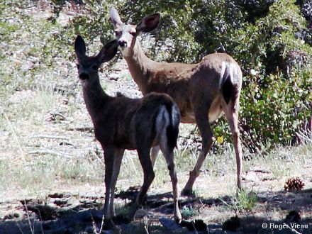
I saw these 2 this morning along 3N12! Sirius didn't see them, he was sleeping.
Re: Forest Service Road Conditions 2011
©ammy, Fri May 27 2011, 09:26PM
Ok, time to catch up... Been too busy exploring the roads to post about the roads!
2N10 was in good shape a week ago, but there were some mud puddles that might make the road impassable for a low-clearance car. However, those will dry up shortly. Here's a Google Map of 2N10: [Click Here] Google Maps incorrectly labels the east end of 2N10 (marked as A on the previous map link). The east side of 2N10 is actually at B on this map: [Click Here] and you can see in the satellite view that the road goes pretty much west from B toward the words "Moonridge Truck Trail 2N10".
3N11 leaves 3N16 just east of Big Pine Flat and goes up to the North. Here's a map of the portion we drove a week ago today: [Click Here] This portion definitely requires a high clearance vehicle, and 4WD would be helpful near the top (B on the map) although we were able to make it up without 4WD.
Last Sunday we left Fawnskin and ended up in Green Valley Lake by taking dirt roads! We took 3N14 out of Fawnskin to Big Pine Flat, then took 3N16 to Green Valley Lake Road - map: [Click Here] We did not need 4WD on this route, but the high clearance of the Tundra was nice to have.
On the way back to Fawnskin, we took 3N34 for about a mile to the west. Google Maps incorrectly labels this route as 2W03: [Click Here] As we were driving west on this road, we pulled over to let a bunch of heavy equipment by - a road grader, tractor and bulldozer - they had just graded the road and the dirt was really soft. I put the truck in 4WD a couple of times just to make sure I didn't get stuck in the super soft dirt. We turned around after a mile because we talked to a guy in a Jeep that recommended we not take the truck any farther on this road. On the way back, we made a loop on 2N31Y which is just north of 3N34 but is not shown on Google Maps. This road is about 1/2 mile long and despite it's green circle rating, is not the kind of road a low clearance vehicle could handle.
Re: Forest Service Road Conditions 2011
©ammy, Fri May 27 2011, 09:32PM
Yesterday, I went to check out 3N54 which Google Maps incorrectly labels as 3N19 - map: [Click Here] 3N54 leaves 3N16 at point A on this map and the road ends at a pile of large rocks at point B on the map. The road that's labeled as Furnace Creek Rd shown inside the hook of 3N54 (3N19 on the map) is blocked off and no longer passable for vehicles. I was in our Jeep Wrangler yesterday on 3N54 and did not need to use 4WD. However, this road would not be passable in a low clearance vehicle.
Re: Forest Service Road Conditions 2011
©ammy, Mon May 30 2011, 09:20PM
We took a quick drive out from Fawnskin through Big Pine Flat today. 3N14 between Fawnskin and Big Pine Flat has been recently graded so I believe that a low clearance vehicle would have no trouble making it on this road. 3N16 east of Big Pine Flat has also seen some recent grading but it appears they're not done with it yet. I would still recommend a higher clearance vehicle to travel this part of the road, although 4WD shouldn't be necessary.
Re: Forest Service Road Conditions 2011
©ammy, Mon Jun 06 2011, 08:14PM
R and I were out on 3N16 today and found that they've put asphalt down for about 1/4 mile right in front of the Holcomb Valley Campground - map: [Click Here]
Re: Forest Service Road Conditions 2011
Mtngoat John⭐, Mon Jun 06 2011, 08:33PM
Well isn’t that fantastic! As if it wasn’t bad enough to put down road base and lime. FS tried to tell me that is was because of the run off into the lake from the sediment on the roads like 2N09. Hmmmm backside of 3N12 doesn’t directly run off into the lake. Wonder what the excuse here is? Next thing they will pave 3N69 so folks can easily get to Gold Mountain. Maybe sanitize John Bull cuz folks “deserve” to see that area without earning it.
Re: Forest Service Road Conditions 2011
©ammy, Mon Jun 06 2011, 08:37PM
The base and lime is eroding just as well as the former road surface was. Except now, there's un-natural road base and lime flowing into the streams & lakes!
R thinks they paved in front of Holcomb Valley Campground to keep the dust down on the campsite. I know there's also pavement in front of Hanna Flat Campground.
Re: Forest Service Road Conditions 2011
Mtngoat John⭐, Mon Jun 06 2011, 08:52PM
God forbid campers in a primative campground like Holcomb get dusty. As I remember they first said the road base was to ease access and to cut down on erosion as you mentioned. Only thing I have noticed that soon after some sections get paved and folks who would normally drive slowly due to ruts are doing 35-40 on some of the roads.
Re: Forest Service Road Conditions 2011
©ammy, Mon Jun 06 2011, 09:02PM
After one winter though, the road base isn't in such great shape in some parts. 2N09 - Polique Canyon Road is really bumpy on the north end, 3N12 - Delamar Mountain Road has some good ruts in it from people spinning their tires and there's also one nicely eroded section that I slow nearly to a stop to cross. It may have sounded like a good idea when they pitched it, but it hasn't held up well in some places. I've seen evidence of grading on lots of roads this spring, but they were all dirt roads. I haven't seen any evidence of the roads with the new base being maintained yet.
Re: Forest Service Road Conditions 2011
©ammy, Mon Jun 06 2011, 09:08PM
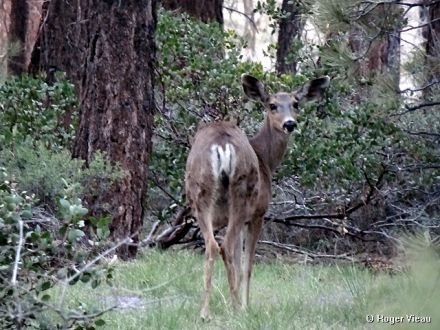
We saw another deer yesterday evening near where I saw the 2 about a week and a half ago.
Re: Forest Service Road Conditions 2011
Mtngoat John⭐, Mon Jun 06 2011, 09:12PM
At the risk of turning this into a politics thing, great way to spend our tax dollars. Wasn’t much more wrong with the roads 2 years ago than there is now with the “new upgrades”. But of course I like bumpy dirt roads.
Nice picture Cammy, I love seeing wildlife!
Re: Forest Service Road Conditions 2011
©ammy, Mon Jun 06 2011, 09:24PM
Thanks! We enjoy the wildlife too! R mentioned we should go for our drives around sunset and maybe we'll see more than we've been seeing.
Re: Forest Service Road Conditions 2011
bills grandson, Mon Jun 06 2011, 09:37PM
It would be nice to see them make a comeback.
yes sunset and sunrise are the best times. It is good to park downwind of a place you see them and often they will come out near sundown. near water is the best Often it is a little to late to get a good picture
Re: Forest Service Road Conditions 2011
dd, Mon Jun 06 2011, 10:09PM
Come on Goat Boy. It's just another obstacle in the new sport of Car vs Mtn Bike. Besides, more people know my name when they can drive like maniacs out there.

Re: Forest Service Road Conditions 2011
Mtngoat John⭐, Mon Jun 06 2011, 10:28PM
Very funny!! I had something to that effect written after the post about Holcomb campground. Back spaced it away as most wouldn't know what we were talking about. Probably can figure it out now.
Re: Forest Service Road Conditions 2011
©ammy, Tue Jun 07 2011, 09:14PM
Out on a drive to Big Pine Flat a couple days ago, we discovered that 3N97 - map: [Click Here] and 3N97A - map: [Click Here] have recently been reopened! 3N97 is only open to the Ironwood Group Camp which is at "B" on the 3N97 map. This road is in good shape and could possibly be traversed in a low clearance vehicle. We did not need 4WD here. 3N97A has deep ruts in it so you'll want to choose your route carefully if you go on this road. 4WD is not necessary but a high clearance vehicle is a must to get over & through the deep ruts.
Other roads in this area - if you're looking at the Google Map, you'll notice a 3N97B. That road only goes about 1/2 as far as the map shows and it ends at a Yellow Post campsite. We did not drive on 3N04Y as it looks like it's supposed to be blocked off on the south end. We did verify it IS still fenced off at the north end.
©ammy, Tue Apr 26 2011, 09:58PM
Yesterday as R and I were taking Sirius for his first offroad adventure, I had the idea to start a thread on here to post current conditions of the various Forest Service dirt roads around the Big Bear area. Feel free to share any info y'all find as you drive/bike/hike along these roads including road condition, recently re-opened gates, closed gates, snow on the road, washed out sections of road, and anything else interesting and helpful.
We discovered yesterday that the gates on 3N08 - map: [Click Here] have re-opened for, as far as I know, the first time since the Butler 2 Fire! We checked the gates on both ends of 3N08 (basically located at A & B on the previous map) to confirm that they're both open and they are. But we did not drive the whole length of 3N08, we turned north on 3N89 (Greenlead Road) - map of the route we took: [Click Here] and found that the fence that was across 3N89 at 3N16 is now open as well! (The fence is at B on the previous map.) There is water flowing across 3N08 at Greenlead Creek, and there are a couple more small streams to cross but these pose no challenge as they're not too deep. We did use 4WD a couple of times in our Toyota Tundra as there are a couple of tricky sections that I didn't want to try in 2WD. You'll definitely want a high clearance vehicle for this route (3N08 to 3N89).
Here's a complete map of our trip: [Click Here] We drove along 3N14 to 3N08. 3N14 is a good road that can be driven in 2WD with no problem. After we took 3N08 to 3N89 we ended up on 3N16. This is another good road and we had no trouble navigating it in 2WD. When we got to 3N12, we took it up around the north side of Delamar Mountain back to 3N14. There is one patch of snow on 3N12, but we had no trouble crossing it in 2WD as there are ruts in the snow from other vehicles going through before us. I also took our Jeep Wrangler through there today in 2WD with no trouble. The snow will probably have melted off the road within a week.
Re: Forest Service Road Conditions 2011
Deb Doodah, Tue Apr 26 2011, 10:29PM
I clicked on your first map and it gave me a subdivision off the 60 in Riverside.
. We went exploring a bit on Sunday but I am not sure of the road numbers. But we did pass Camp Whittle. That road was fine with a couple of spots with some mud - just enough to make my wheel wells caked with mud.
Re: Forest Service Road Conditions 2011
Mtngoat John⭐, Tue Apr 26 2011, 10:40PM
Deb, you were on 3N14. Don't need to know the road #'s unless there is a problem. Heck BGS never got lost as far as I know.
Re: Forest Service Road Conditions 2011
Deb Doodah, Tue Apr 26 2011, 10:46PM
Mtn.goat John wrote ...
Deb, you were on 3N14. Don't need to know the road #'s unless there is a problem. Heck BGS never got lost as far as I know.
Deb, you were on 3N14. Don't need to know the road #'s unless there is a problem. Heck BGS never got lost as far as I know.
I don't think there was much chance of getting lost. All the forest roads are on the cars gps which I thought was really cool. Plus we didn't go very far. We aren't as big adventurers as you guys. Yet!
Re: Forest Service Road Conditions 2011
bills grandson, Wed Apr 27 2011, 05:33AM
nope never lost in the woods. Sometimes the place I was looking for might get lost.
I think the hardest thing was learning my way around upper moon ridge.
Cities forget about it. It is almost impossible to get around down here. No straight lines to take you anywhere. I just got a GPS which helps but I am already looking to upgrade. A couple of weeks of rebuilding my dash to get everything right. And now I want to rip it out and start over. New radio with all the bells and whistles you can think of. 300. at walmart. Every other one I have seen like it is 800.
I was thinking the other day that it doesn't seem like that long ago that cars had no seat belts, turn signals, or radio's. Heaters were a luxery, and almost no air conditioning. First cars I bought really didn't have a two foot square place needed for one.
Had to wait for a minute for the tubes to heat up.
Do you even have to learn hand signals anymore to drive a car? And would anyone know what you were doing? Probably get shot for throwing "gang signs".
I think Cammy has a great idea. I have always wanted to get people out to enjoy the beauty most don't even know is all around them. To bad there are so few animals to share it with anymore.
Re: Forest Service Road Conditions 2011
©ammy, Wed Apr 27 2011, 10:28AM
Debbie Doodah wrote ...
I clicked on your first map and it gave me a subdivision off the 60 in Riverside. .
I clicked on your first map and it gave me a subdivision off the 60 in Riverside.
. Anyone else have this problem?
Re: Forest Service Road Conditions 2011
Lumber Jill, Wed Apr 27 2011, 10:42AM
©ammy wrote ...
Anyone else have this problem?
Debbie Doodah wrote ...
I clicked on your first map and it gave me a subdivision off the 60 in Riverside. .
I clicked on your first map and it gave me a subdivision off the 60 in Riverside.
. Anyone else have this problem?
Nope...looks like Holcomb Valley to me!
Re: Forest Service Road Conditions 2011
bills grandson, Wed Apr 27 2011, 10:44AM
Cammy I had no problem.
Make sure you write what condition the roads are in and what kind of vehicle you might need. So a street car can be taken on while others need 4WD. And some are not even begginer 4WD As well as any high lights or things to see along the way. I will try to add what things I know or have learned about each stretch also.
Re: Forest Service Road Conditions 2011
©ammy, Wed Apr 27 2011, 10:54AM
Yesterday's adventures included leaving Fawnskin on 3N14 to 3N12 to 3N16 to 3N32 up 3N10 to the east a little bit, turned around, back down 3N32 to 3N16 to 2N09 to Hwy 38. Here's an incomplete map, as 3N32 doesn't show up on Google Maps: [Click Here] 3N32 goes to the north from 3N16 at B on this map: [Click Here] but 3N32 is not Burnt Flat Road. That road doesn't actually exist as it's been fenced off some time ago.
Anyway, to the road conditions: we covered the portions of 3N14 & 3N12 in the first post. 3N16 between 3N12 & 3N32 - map: [Click Here] is in good shape - it was resurfaced with that gravel/sand mix a year or so ago, so passenger cars would have no trouble navigating this section. 3N32 is a road that a high clearance vehicle would be good to use as there are a lot of deep ruts in this road. I didn't need to use 4WD on this road at all, but the high clearance was helpful. There was a mud puddle about 1/4 mile in on the road that could be bypassed but that's no fun!
There is also a small stream crossing on this road, but the water is shallow and no problem to cross. The north end of 3N32 is where it intersects 3N10. I went east on 3N10 for maybe a half mile before I decided it would be better to not get the Jeep stuck on the rocks so I turned around. I did use 4WD a couple of times on 3N10. After I turned around, I went back on 3N32 to 3N16 to 2N09. I took 2N09 back to Highway 38 - map: [Click Here]. This is another road that was resurfaced a year or so ago, and while it is a bumpy ride in some spots, I think it could be navigated with a passenger car as long as you go slow. The gate on the north end of Van Dusen Canyon Road (3N09) is still closed - A on this map: [Click Here] so I assume the gate at the south end of this road is still closed as well - B on previous map. Also, the gate at 3N12 & 2N84 - A on this map: [Click Here] has been closed since the Butler 2 Fire and as of yesterday is still closed.
I'll check the gates on both ends of 2N93 today (Wildhorse Meadows Road) but I'd be really surprised if they're open as there's still a good amount of snow on the north side of Sugarloaf Mountain.
Re: Forest Service Road Conditions 2011
©ammy, Wed Apr 27 2011, 10:56AM
Here are some videos from yesterday. The first 2 videos are sped up about 5x. The last one is at real time speed.
3N12
3N16 from 3N12 to 3N32
3N32 Mud Puddle!
Re: Forest Service Road Conditions 2011
©ammy, Wed Apr 27 2011, 11:06AM
Here are a couple pictures from the past 2 days' adventures. More to come but I'm off now to go be "Where In So Cal Is Cammy San Diego".
Sirius Explorer
View from a ways off the road - 3N32
Re: Forest Service Road Conditions 2011
Lumber Jill, Wed Apr 27 2011, 11:06AM
Damn you drive fast when I'm not around!
Re: Forest Service Road Conditions 2011
bills grandson, Wed Apr 27 2011, 11:41AM
Cool video. Forest looks great 3x time would have been the way I like to roll sometimes.
I guess I will have to start learning the numbers for the roads
Re: Forest Service Road Conditions 2011
©ammy, Wed Apr 27 2011, 05:28PM
2N93 still hasn't opened for the season yet. Also, the gate on 2N13 at 3N14 is still closed. 2N13 is the road to get to Butler Peak.
Re: Forest Service Road Conditions 2011
©ammy, Fri Apr 29 2011, 09:09PM
©ammy wrote ...
Here are a couple pictures from the past 2 days' adventures. More to come
Here are a couple pictures from the past 2 days' adventures. More to come


Re: Forest Service Road Conditions 2011
Juliann, Fri Apr 29 2011, 09:34PM
Have you heard if the public will be allowed to drive to Butler Peak this summer?
Re: Forest Service Road Conditions 2011
©ammy, Fri Apr 29 2011, 09:42PM
I have not heard either way. I'll let y'all know on here once they reopen it.
Re: Forest Service Road Conditions 2011
©ammy, Sun May 01 2011, 07:42PM
Update from yesterday - The snow patch is barely noticeable on 3N12, in fact we saw a small Honda car (Civic, I think) that I have to assume passed over the snow patch unless they drove up & turned around before it.
We completed the eastern section of 3N08 - map: [Click Here]. 4WD is a must for this part of the road as there is a steep, rocky section of the road.
3N14 from 3N08 to Big Pine Flat is in great shape and I believe a passenger car would have no trouble making it from Fawnskin to Big Pine Flat on this route - map: [Click Here]
From Big Pine Flat you can head East on 3N16 which is supposed to be a good road (green rating, I believe). But there is a section just east of Big Pine Flat that had seen much erosion in the past few years. We did not need 4WD for any of this road yesterday. We went all the way to 2N09 - map: [Click Here] but the higher clearance of the Tundra was nice to have. There was one spot where I tried to cross a rutted section on the road and ended up having only my left front and right rear wheels on the ground!
I had to back up and approach the rut from a different angle to get through. 3N97 - map: [Click Here] and 3N04Y - map: [Click Here] have been closed, I believe, since the Butler 2 Fire. They still have closed gates at the A & B markers on the previous 2 map links.
Re: Forest Service Road Conditions 2011
Lumber Jill, Sun May 01 2011, 07:57PM
©ammy wrote ...
We completed the eastern section of 3N08 - map: [Click Here]. 4WD is a must for this part of the road as there is a steep, rocky section of the road.
We completed the eastern section of 3N08 - map: [Click Here]. 4WD is a must for this part of the road as there is a steep, rocky section of the road.
A change of underwear is helpful, also
Re: Forest Service Road Conditions 2011
©ammy, Sun May 01 2011, 08:18PM
® wrote ...
A change of underwear is helpful, also
A change of underwear is helpful, also
Oops! Sorry 'bout that!
Re: Forest Service Road Conditions 2011
©ammy, Tue May 03 2011, 04:58PM
Today's short adventure was on roads 2N09, 2N71, 3N12 & 3N14. 2N71 is the only road I haven't recently covered. This road is in good shape and I'd think a passenger car could handle this road except it may have trouble with one spot near the west end of the road where a stream eroded a deep channel across the road. It's deep enough that I basically came to a stop with my front wheels in the channel and then proceeded to give the Jeep some gas to move through the channel.
[Click Here] for a Google Map with my GPS track on these roads.
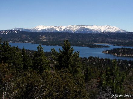
Here's a video I took of 2N71, including a stop with a fantastic view overlooking Big Bear Lake and the snow covered peaks of the San Gorgonio Wilderness:
Re: Forest Service Road Conditions 2011
Mtngoat John⭐, Tue May 03 2011, 06:10PM
From 4-22 looks like a lot of snow has melted on San G since then. Popular spot to take a photo
Re: Forest Service Road Conditions 2011
©ammy, Tue May 03 2011, 07:07PM
Well what a surprise! I do have a photo from there today!
Re: Forest Service Road Conditions 2011
Lumber Jill, Tue May 03 2011, 07:56PM
The question is how many hundreds of photos do you have from that spot?
Re: Forest Service Road Conditions 2011
©ammy, Tue May 03 2011, 08:01PM
Probably multiple hundreds!Re: Forest Service Road Conditions 2011
Deb Doodah, Tue May 03 2011, 08:05PM
I think we have pictures from that spot too!
Re: Forest Service Road Conditions 2011
bills grandson, Tue May 03 2011, 08:28PM
When they improved that road from a jeep trail that became a very familiar picture. Even 90 years ago the view was captured. This from a bit lower.
Great to see the video the trees look so much better then a few years ago.
Re: Forest Service Road Conditions 2011
©ammy, Tue May 03 2011, 08:32PM
Based on the snow in what's now the San Gorgonio Wilderness, that picture looks like it's from about the same time of year.
Re: Forest Service Road Conditions 2011
bills grandson, Wed May 04 2011, 05:03AM
That is one of the many a friend sent. I think all are posted in the photo's section. I sent that in high res and if you download it and blow it up there is a huge building along the lake I have no idea what it is. I think the picture was take in the late 1910's. I know it sounds very old man but even I can remember wgen there was still a lot o snow on San G as late as July. But Spring is the best time to get pictures.
I think I have one that I took from the same spot when they first upgraded that road.
Re: Forest Service Road Conditions 2011
Mtngoat John⭐, Wed May 04 2011, 06:03AM
Funny, I went through and looked I have quite a few from up there. Definately a great spot to take photos.
BG great old photo! Love seeing the difference in the trees and the area. Thanks
Re: Forest Service Road Conditions 2011
bills grandson, Wed May 04 2011, 07:11AM
There are a bunch of them. Very high quality. Came from a member who passed them on through me. They were used to make many of the old post cards.
What would be fun is to set up a camera at that spot that would be motion activated just to see how many people stop and take a picture within those few hundred feet. Views looking down on the lake from several points, and anything showing majestic views of San G have got to be the most popular and this one has both features.
Re: Forest Service Road Conditions 2011
©ammy, Fri May 06 2011, 09:16PM
Don't go on 3N02. That road wants to eat you! R can tell you more.
Re: Forest Service Road Conditions 2011
melvin, Sat May 07 2011, 02:10PM
the road to hart bar and the yellow post sites is open.. you cant get up to the aspen grove yet
Re: Forest Service Road Conditions 2011
©ammy, Sat May 07 2011, 07:05PM
Thanks for the info, Mel! If I'm understanding you correctly, 1N02 is open - map: [Click Here] (I believe that east of marker B on the previous map is private property and there is a gate across 1N02.) Mel - did you take 1N02 from Highway 38, past the yellow post sites all the way up to the Coon Creek Cabin?
1N05 - map: [Click Here] past the parking area for the Aspen Grove, and up to the Fish Creek Trailhead, is still not open for the season.
Re: Forest Service Road Conditions 2011
©ammy, Sat May 07 2011, 07:15PM
©ammy wrote ...
Don't go on 3N02. That road wants to eat you! R can tell you more.
Don't go on 3N02. That road wants to eat you! R can tell you more.
Since R is apparently still too traumatized by the incident yesterday, I'll explain. I got the truck stuck in a big, mud-filled rut on this road. But a few minutes of digging with the shovel we keep in the truck for this exact reason and we were freeeeeee!
Additionally from yesterday - all the snow has now melted off of the road on 3N12. 3N05 around Holcomb Valley Campground is in decent shape, but low-clearance vehicles could have trouble if you're not careful. 3N07 - farther north from the Holcomb Valley campground is in fine shape until about 1/4 mile from the east end of this road, there's a creek crossing with water covering the whole road which is pretty sandy in this area. I decided against giving the truck a mud bath here, not wanting to risk getting stuck for a second time in the same trip.
Re: Forest Service Road Conditions 2011
Lumber Jill, Sat May 07 2011, 07:29PM
not traumatized at all...i knew you'd dig us out! with an emphasis on YOU
<3Re: Forest Service Road Conditions 2011
bills grandson, Sat May 07 2011, 08:06PM
Cammy
If you don't have a winch look into buying a wagon jack. One of the tall heavy ones. I think the trade name is hi-jacker They are great and can be used as a winch at times. Also some plywood in case it is really muddy.
Also take 2 shovels.
".....there ain't no free ride"
Re: Forest Service Road Conditions 2011
Lumber Jill, Sat May 07 2011, 08:19PM
hey! i didn't get us stuck! in reality i was feeling pretty crappy and he was a sweetie for not hoping i'd get out and help.
Re: Forest Service Road Conditions 2011
bills grandson, Sat May 07 2011, 08:30PM
Just kidding
besides your not married yet so you get a pass.
Re: Forest Service Road Conditions 2011
Lumber Jill, Sat May 07 2011, 08:34PM
ahahaha
Re: Forest Service Road Conditions 2011
©ammy, Sat May 07 2011, 08:44PM
bills grandson wrote ...
Cammy
If you don't have a winch look into buying a wagon jack. One of the tall heavy ones. I think the trade name is hi-jacker They are great and can be used as a winch at times. Also some plywood in case it is really muddy.
Also take 2 shovels.
".....there ain't no free ride"
Cammy
If you don't have a winch look into buying a wagon jack. One of the tall heavy ones. I think the trade name is hi-jacker They are great and can be used as a winch at times. Also some plywood in case it is really muddy.
Also take 2 shovels.
".....there ain't no free ride"
Other than the mud puddles that I enjoy splashing through, I'm really not trying to do anything crazy in the truck. And I will turn around if a mud puddle looks like it can get me. I also stay away from the overly rocky sections in particular. Funny thing about yesterday's adventure is that I made it over this section of road just fine the first time. It was coming back that got me.
I just wasn't completely paying attention to my route when straddling the deep ruts and I got into the wrong spot. Normally, I stay clear of anything even remotely as bad as this, but I was being stubborn yesterday. And ya, I got us stuck so I was going to get us out. I didn't expect R to help me out. I'm stubborn that way too!
Re: Forest Service Road Conditions 2011
melvin, Sun May 08 2011, 03:47AM
©ammy wrote ...
Thanks for the info, Mel! If I'm understanding you correctly, 1N02 is open - map: [Click Here] (I believe that east of marker B on the previous map is private property and there is a gate across 1N02.) Mel - did you take 1N02 from Highway 38, past the yellow post sites all the way up to the Coon Creek Cabin?
1N05 - map: [Click Here] past the parking area for the Aspen Grove, and up to the Fish Creek Trailhead, is still not open for the season.
i did not go all the way to the cabin but i saw a forest service truck coming from that direction.. i went to the right at the 2nd fork to the other yellow post sites and the ca biking and hiking trail..
Re: Forest Service Road Conditions 2011
melvin, Sun May 08 2011, 03:50AM
and yes past the cabin there is a fince going across the rd.. ive always been tempted to go anyway to see whats there
Re: Forest Service Road Conditions 2011
bills grandson, Sun May 08 2011, 07:34AM
The story of that area is very interesting as told to me by my mother.
It was owned by a Big Bear local J.B, Quail (spelling? probably Quayl)
It was at least one section, possibly more of school, or R.R.land. There are several in that area privetly owned. When he purchased the land he sold timber which covered the cost of the land. Heart bar was donated for tax purpoes. There is another home beyond the fence. As far as I know till owned by the family. When they were looking for a site for bouncing T.V. tinto Yucca valley they leased property from him for their tower. So part of that deal was the home has power from their generator, and T.V.
pretty sharp Don't ask me how they get fuel up there
I have never been past the gate either but google earth show a lot of roads back in that area that I never had a clue about.
PCT crosses right at the cabin and I once met an older man who was hiking the entire trail. He did it in sections being let off at one place then picked up at the next by his wife. Then next time he was up to it he would do another.
Re: Forest Service Road Conditions 2011
Mtngoat John⭐, Sun May 08 2011, 08:22AM
I have been past the gate. Maybe a quarter to a half mile past the house there. Decided not to go further as I was alone and was getting an eerie feeling like I was being watched.
About a week later I was informed by a law enforcement friend in Shay Meadows that I should not be “snooping around down there”. He would not expand on that info, but in the context of our conversation I knew exactly what he meant.
Re: Forest Service Road Conditions 2011
bills grandson, Sun May 08 2011, 08:47AM
Strange
I always try to respect private property. Not so much fences on public land.
I was looking at google and saw the second house not far from the first. And by the looks of the roads it looks like some may at one time go clear to the Yucca valley area. Also you can see what I take was the onyx mines I have heard about between there and pipes canyon. That did have a road to the desert but I think was washed out long ago. Much more in there then I knew about. Rough country.
A very long time ago a friend had told me that there was a missle site put in during the cold war. He had indicated it was in Jacoby canyon. Turns out that was B.S. but there is one near Wrightwood. Could there be one there also?
Re: Forest Service Road Conditions 2011
©ammy, Mon May 09 2011, 09:24PM
We noticed that the gates to 2N93/Wildhorse Meadows Road opened yesterday - map: [Click Here] so we went for a drive up there today. The road weathered the winter rather well! I drove this road in a small car (Mercury Topaz) ~ 7 years ago with no problem, and I think it would be possible to do it again in a passenger car, but I'd recommend doing it from south to north as there's a section less than a mile in on the south side that might be challenging for low-clearance vehicles. We did not use 4WD in the Tundra at all on this road. Also, the snow is all gone from the road.
After 2N93, I had the idea to get back to Fawnskin on dirt roads as much as we could. So we made the quick drive up Hwy 38 over Onyx Summit to 2N01 - map: [Click Here] which is also in very good shape and I believe could be traveled on with a passenger car. We did not use 4WD on this road either.
When we got to the north end of 2N01, we turned left onto 2N02/Burns Canyon Road - map: [Click Here] which R and I both concluded would not be passable in a passenger car. R visually and verbally concluded this, while I used the underside of the truck and a large rock in the road to make my conclusion. This was just east of the Arrastre Creek crossing. I did put the truck in 4WD to cross Arrastre Creek as the water is rather deep here (maybe up to the bottom of the doors in the Tundra?) and I didn't care to take any chances getting stuck.
Lastly, we took 3N16 west from near the dump to 3N12 to 3N14. I've previously covered all of these roads except for the eastern portion of 3N16, but it's not really any different than the rest of it although you'd want to carefully choose your route on this road between the dump and Doble Mine if you were in a low-clearance vehicle.
Here's a GPS track/map of our adventure today: [Click Here]
Additionally, we noticed that the north gate on 3N09/Van Dusen Canyon Road is open so I'm assuming the south gate is now open as well. Here's a map of this road: [Click Here]
Re: Forest Service Road Conditions 2011
bills grandson, Mon May 09 2011, 09:48PM
The South part of the Wildhorse road is usually rocky. While the North part to the top is not to bad. If you are new at off road I would start with that. Van Dusen is always my favorite into Holcomb. Ten minutes and your in the middle of the place. I really hope those who have not gotten out in the woods find time this year. Many of the roads are not bad at all. And almost all can be done after you have a little expirence. In Holcomb you can stop anywhere and find history within fifty feet of the road.
Lots of stuff on the history is out there and it is fun to learn about it. Some of the better known ones don't pan out and every mining town has it's version of the same story. The forest service even faked at least one.
Re: Forest Service Road Conditions 2011
©ammy, Tue May 10 2011, 07:27PM
Here are a couple videos from today. The first is 3N09/Van Dusen Canyon Road, going up from Big Bear City into Holcomb Valley. The second is 2N09/Polique Canyon Road from Holcomb Valley back to Highway 38.
Re: Forest Service Road Conditions 2011
©ammy, Tue May 10 2011, 07:39PM
3N09/Van Dusen Canyon Road - map: [Click Here] recently opened for the season, so I drove it today. The road is in great shape and I believe a low-clearance vehicle would have no trouble with this road.
Continuing on my adventure today, I went to check out some roads I hadn't been on in a while. I took 3N10 from 3N16 to 3N43, went down 3N43 to 3N23, took that road across to 3N83 which I followed to 3N16. From 3N16 I headed east to 3N82 which goes back up to 3N83, which I took back to 3N10. These roads aren't shown in Google Maps, but all do appear on topo maps. All of these roads except for 3N16 are definitely for high clearance, 4 wheel drive vehicles only. These roads are also quite narrow. We've driven them all in our 4 door Tundra before, but ended up with some "forest pin striping". Even in the Jeep Wrangler today, there were some narrow sections that I just barely squeezed through.
Here's my GPS track from today: [Click Here]
Re: Forest Service Road Conditions 2011
bills grandson, Tue May 10 2011, 10:05PM
Van Dusen is my all time favorite. I think you could get a lo-rider up it except right below the resivor. But it is a little tight in places for oncoming traffic.
next time up at about 1:10 while going through the cut look across through the trees. There is a strange rock formation we called the hulks hand. Loofs like a fist and arm sticking up about 30 feet tall. really out of place. Kind of hard to find. I think rock climbers might climb it. I was trying to find the two cabins so I could give you a google earth shot but It is hard to find things there sometimes So I will find another way. They are off of the Union flats road at the last place you can turn left before it turns to John bull flats. On the road that goes under the rock There are several fun things in that area including my old gold mining favorite
Re: Forest Service Road Conditions 2011
melvin, Thu May 12 2011, 03:33PM
©ammy wrote ...
Mel - did you take 1N02 from Highway 38, past the yellow post sites all the way up to the Coon Creek Cabin?
Mel - did you take 1N02 from Highway 38, past the yellow post sites all the way up to the Coon Creek Cabin?
yes!!
Re: Forest Service Road Conditions 2011
©ammy, Thu May 12 2011, 09:26PM
melmorial wrote ...
i did not go all the way to the cabin but i saw a forest service truck coming from that direction.. i went to the right at the 2nd fork to the other yellow post sites and the ca biking and hiking trail..
©ammy wrote ...
Mel - did you take 1N02 from Highway 38, past the yellow post sites all the way up to the Coon Creek Cabin?
Mel - did you take 1N02 from Highway 38, past the yellow post sites all the way up to the Coon Creek Cabin?
i did not go all the way to the cabin but i saw a forest service truck coming from that direction.. i went to the right at the 2nd fork to the other yellow post sites and the ca biking and hiking trail..
melmorial wrote ...
yes!!
©ammy wrote ...
Mel - did you take 1N02 from Highway 38, past the yellow post sites all the way up to the Coon Creek Cabin?
Mel - did you take 1N02 from Highway 38, past the yellow post sites all the way up to the Coon Creek Cabin?
yes!!
You went back! Sneaky!
How's the road? No problem in your truck?
Re: Forest Service Road Conditions 2011
melvin, Thu May 12 2011, 09:30PM
yes i went back today and hiked up the hiking and riding trail for a bit then went to the cabin.. the road has the same old bumps and grinds but is in good condition
Re: Forest Service Road Conditions 2011
melvin, Thu May 12 2011, 09:30PM
and no probs in my truck
Re: Forest Service Road Conditions 2011
©ammy, Thu May 12 2011, 09:32PM
Cool! Thanks for the info!
Another trip we gotta make at some point this summer!
Re: Forest Service Road Conditions 2011
©ammy, Tue May 17 2011, 07:05PM
We took 2N02 out to Pioneertown and back on Sunday - map of the dirt portion of this route: [Click Here]
We used 4WD in 3 places on the road - the Arrastre Creek crossing, as the water there is really deep, and we kept the truck in 4WD just after the creek as the road has some big rocks in it. We used 4WD again a while later for a steep, rocky, uphill section that we came down last week in the other direction in 2WD with no problem. The 3rd spot we used 4WD was at the east end of Burns Canyon, just before you get to a paved road, as the last part of the road is basically in a sandy wash. I didn't want to find out how stuck we could get if we stopped here or didn't use 4WD so we played it safe. Other than that, the road is in great shape! On the way back, we took 2N01 - between B & C on this map: [Click Here] and by doing so, avoided 2 of the sections we used 4WD in - the Arrastre Creek crossing and the steep, rocky, uphill (which would be downhill on the way back) section.
Re: Forest Service Road Conditions 2011
Craig ⭐, Tue May 17 2011, 07:54PM
We also ate at Pappy and Harriets in Pioneertown, and I can say thay have DELICIOUS burgers!
Re: Forest Service Road Conditions 2011
bills grandson, Tue May 17 2011, 10:05PM
that entire road used to be a very pleasant almost paved type drive. that last time I drove it it was not a lot of fun beyond rose mine. but again a lot of history on the drive.
Re: Forest Service Road Conditions 2011
, Tue May 17 2011, 10:51PM
Hansberger tried to get it paved. He owns land on it.
Re: Forest Service Road Conditions 2011
bills grandson, Tue May 17 2011, 11:36PM
that was probably to make it easier to get to the casino at rose mine.
I wanted to buy some property once in burns canyon. It was very cheap at the time and about as far from the beaten path as you could get.
Re: Forest Service Road Conditions 2011
melvin, Wed May 18 2011, 01:45PM
its not really a forest rd but meadows edge is open now!!
Re: Forest Service Road Conditions 2011
©ammy, Wed May 18 2011, 08:09PM
Oh cool! I just discovered that spot last year, and I like it!
Re: Forest Service Road Conditions 2011
melvin, Thu May 19 2011, 04:29PM
its open!!

Re: Forest Service Road Conditions 2011
bills grandson, Thu May 19 2011, 06:00PM
all right I had to go to triple A today to update my registration and I got a map so now maybe I can speak toad numbers and translate to something I understand.
I will try to put together a map with the numbers, and their names, and the names of spots along the way
Re: Forest Service Road Conditions 2011
Deb Doodah, Thu May 19 2011, 07:22PM
bills grandson wrote ...
all right I had to go to triple A today to update my registration and I got a map so now maybe I can speak toad numbers and translate to something I understand.
I will try to put together a map with the numbers, and their names, and the names of spots along the way
all right I had to go to triple A today to update my registration and I got a map so now maybe I can speak toad numbers and translate to something I understand.
I will try to put together a map with the numbers, and their names, and the names of spots along the way
Toads have numbers? Cool.
Sorry just couldn't resist.
Re: Forest Service Road Conditions 2011
bills grandson, Thu May 19 2011, 07:51PM
you got me.
not hard to do.
I wont fix it or nobody would get it
Re: Forest Service Road Conditions 2011
©ammy, Thu May 19 2011, 09:37PM
melmorial wrote ...
its open!!
its open!!
Sweet! Thanks for the info!
Re: Forest Service Road Conditions 2011
©ammy, Fri May 20 2011, 12:00PM
If I heard my scanner right, it sounds like the Forest Service is in the process of opening the gates on 2N10 & 2N08!
Re: Forest Service Road Conditions 2011
Craig ⭐, Fri May 20 2011, 01:05PM
I heard the same thing Cammy!!
Re: Forest Service Road Conditions 2011
Lumber Jill, Fri May 20 2011, 02:55PM
Yup! 2N10 is open!
Re: Forest Service Road Conditions 2011
melvin, Fri May 20 2011, 04:37PM
wheeee!!! enjoy the forest before they close it
Re: Forest Service Road Conditions 2011
©ammy, Mon May 23 2011, 09:25AM
This past weekend.... 2N10, 3N11, 3N16 to Green Valley Lake, 3N34 (only a mile or so) 2N31Y... Details to follow when im back at my computer.
Re: Forest Service Road Conditions 2011
©ammy, Thu May 26 2011, 12:36PM
I saw these 2 this morning along 3N12! Sirius didn't see them, he was sleeping.

Re: Forest Service Road Conditions 2011
©ammy, Fri May 27 2011, 09:26PM
©ammy wrote ...
This past weekend.... 2N10, 3N11, 3N16 to Green Valley Lake, 3N34 (only a mile or so) 2N31Y... Details to follow when im back at my computer.
This past weekend.... 2N10, 3N11, 3N16 to Green Valley Lake, 3N34 (only a mile or so) 2N31Y... Details to follow when im back at my computer.
Ok, time to catch up... Been too busy exploring the roads to post about the roads!
2N10 was in good shape a week ago, but there were some mud puddles that might make the road impassable for a low-clearance car. However, those will dry up shortly. Here's a Google Map of 2N10: [Click Here] Google Maps incorrectly labels the east end of 2N10 (marked as A on the previous map link). The east side of 2N10 is actually at B on this map: [Click Here] and you can see in the satellite view that the road goes pretty much west from B toward the words "Moonridge Truck Trail 2N10".
3N11 leaves 3N16 just east of Big Pine Flat and goes up to the North. Here's a map of the portion we drove a week ago today: [Click Here] This portion definitely requires a high clearance vehicle, and 4WD would be helpful near the top (B on the map) although we were able to make it up without 4WD.
Last Sunday we left Fawnskin and ended up in Green Valley Lake by taking dirt roads! We took 3N14 out of Fawnskin to Big Pine Flat, then took 3N16 to Green Valley Lake Road - map: [Click Here] We did not need 4WD on this route, but the high clearance of the Tundra was nice to have.
On the way back to Fawnskin, we took 3N34 for about a mile to the west. Google Maps incorrectly labels this route as 2W03: [Click Here] As we were driving west on this road, we pulled over to let a bunch of heavy equipment by - a road grader, tractor and bulldozer - they had just graded the road and the dirt was really soft. I put the truck in 4WD a couple of times just to make sure I didn't get stuck in the super soft dirt. We turned around after a mile because we talked to a guy in a Jeep that recommended we not take the truck any farther on this road. On the way back, we made a loop on 2N31Y which is just north of 3N34 but is not shown on Google Maps. This road is about 1/2 mile long and despite it's green circle rating, is not the kind of road a low clearance vehicle could handle.
Re: Forest Service Road Conditions 2011
©ammy, Fri May 27 2011, 09:32PM
Yesterday, I went to check out 3N54 which Google Maps incorrectly labels as 3N19 - map: [Click Here] 3N54 leaves 3N16 at point A on this map and the road ends at a pile of large rocks at point B on the map. The road that's labeled as Furnace Creek Rd shown inside the hook of 3N54 (3N19 on the map) is blocked off and no longer passable for vehicles. I was in our Jeep Wrangler yesterday on 3N54 and did not need to use 4WD. However, this road would not be passable in a low clearance vehicle.
Re: Forest Service Road Conditions 2011
©ammy, Mon May 30 2011, 09:20PM
We took a quick drive out from Fawnskin through Big Pine Flat today. 3N14 between Fawnskin and Big Pine Flat has been recently graded so I believe that a low clearance vehicle would have no trouble making it on this road. 3N16 east of Big Pine Flat has also seen some recent grading but it appears they're not done with it yet. I would still recommend a higher clearance vehicle to travel this part of the road, although 4WD shouldn't be necessary.
Re: Forest Service Road Conditions 2011
©ammy, Mon Jun 06 2011, 08:14PM
R and I were out on 3N16 today and found that they've put asphalt down for about 1/4 mile right in front of the Holcomb Valley Campground - map: [Click Here]
Re: Forest Service Road Conditions 2011
Mtngoat John⭐, Mon Jun 06 2011, 08:33PM
Well isn’t that fantastic!
As if it wasn’t bad enough to put down road base and lime. FS tried to tell me that is was because of the run off into the lake from the sediment on the roads like 2N09. Hmmmm backside of 3N12 doesn’t directly run off into the lake. Wonder what the excuse here is? Next thing they will pave 3N69 so folks can easily get to Gold Mountain. Maybe sanitize John Bull cuz folks “deserve” to see that area without earning it. Re: Forest Service Road Conditions 2011
©ammy, Mon Jun 06 2011, 08:37PM
The base and lime is eroding just as well as the former road surface was. Except now, there's un-natural road base and lime flowing into the streams & lakes!
R thinks they paved in front of Holcomb Valley Campground to keep the dust down on the campsite. I know there's also pavement in front of Hanna Flat Campground.
Re: Forest Service Road Conditions 2011
Mtngoat John⭐, Mon Jun 06 2011, 08:52PM
God forbid campers in a primative campground like Holcomb get dusty. As I remember they first said the road base was to ease access and to cut down on erosion as you mentioned. Only thing I have noticed that soon after some sections get paved and folks who would normally drive slowly due to ruts are doing 35-40 on some of the roads.
Re: Forest Service Road Conditions 2011
©ammy, Mon Jun 06 2011, 09:02PM
After one winter though, the road base isn't in such great shape in some parts. 2N09 - Polique Canyon Road is really bumpy on the north end, 3N12 - Delamar Mountain Road has some good ruts in it from people spinning their tires and there's also one nicely eroded section that I slow nearly to a stop to cross. It may have sounded like a good idea when they pitched it, but it hasn't held up well in some places. I've seen evidence of grading on lots of roads this spring, but they were all dirt roads. I haven't seen any evidence of the roads with the new base being maintained yet.
Re: Forest Service Road Conditions 2011
©ammy, Mon Jun 06 2011, 09:08PM
We saw another deer yesterday evening near where I saw the 2 about a week and a half ago.

Re: Forest Service Road Conditions 2011
Mtngoat John⭐, Mon Jun 06 2011, 09:12PM
At the risk of turning this into a politics thing, great way to spend our tax dollars. Wasn’t much more wrong with the roads 2 years ago than there is now with the “new upgrades”. But of course I like bumpy dirt roads.
Nice picture Cammy, I love seeing wildlife!
Re: Forest Service Road Conditions 2011
©ammy, Mon Jun 06 2011, 09:24PM
Thanks! We enjoy the wildlife too! R mentioned we should go for our drives around sunset and maybe we'll see more than we've been seeing.
Re: Forest Service Road Conditions 2011
bills grandson, Mon Jun 06 2011, 09:37PM
It would be nice to see them make a comeback.
yes sunset and sunrise are the best times. It is good to park downwind of a place you see them and often they will come out near sundown. near water is the best Often it is a little to late to get a good picture
Re: Forest Service Road Conditions 2011
dd, Mon Jun 06 2011, 10:09PM
Come on Goat Boy. It's just another obstacle in the new sport of Car vs Mtn Bike. Besides, more people know my name when they can drive like maniacs out there.

Re: Forest Service Road Conditions 2011
Mtngoat John⭐, Mon Jun 06 2011, 10:28PM
dd wrote ...
Besides, more people know my name when they can drive like maniacs out there.
Besides, more people know my name when they can drive like maniacs out there.
Very funny!! I had something to that effect written after the post about Holcomb campground. Back spaced it away as most wouldn't know what we were talking about. Probably can figure it out now.
Re: Forest Service Road Conditions 2011
©ammy, Tue Jun 07 2011, 09:14PM
Out on a drive to Big Pine Flat a couple days ago, we discovered that 3N97 - map: [Click Here] and 3N97A - map: [Click Here] have recently been reopened! 3N97 is only open to the Ironwood Group Camp which is at "B" on the 3N97 map. This road is in good shape and could possibly be traversed in a low clearance vehicle. We did not need 4WD here. 3N97A has deep ruts in it so you'll want to choose your route carefully if you go on this road. 4WD is not necessary but a high clearance vehicle is a must to get over & through the deep ruts.
Other roads in this area - if you're looking at the Google Map, you'll notice a 3N97B. That road only goes about 1/2 as far as the map shows and it ends at a Yellow Post campsite. We did not drive on 3N04Y as it looks like it's supposed to be blocked off on the south end. We did verify it IS still fenced off at the north end.