Current Weather @ 4:45 PM Clear skies Temp 52.4º Humidity 29% Winds WSW 0.0mph Max Gust 18.4mph
Todays Extremes High 55.9º Low 35.6º Rain 0.00" Rain Rate 0.000" per hr Snow 0.00" Season 33"
ALERTS (click alert for more info)
None at this time
Welcome
Username:

Password:


Remember me

[ ]
[ ]
SUPPORT SCM!
Support SCM by making a single or recurring donation.


ROADS AND TRAFFIC
Updated: 04:30 PM v2.5
Run Spr to Highland  (330): 21 mins  
Highland to Run Spr  (330): 20 mins  
Big Bear to Run Spr    (18): 22 mins  
Run Spr to Big Bear    (18): 21 mins  
Big Bear to Redlands  (38): 69 mins  
Redlands to Big Bear  (38): 66 mins  
Big Bear to Lucerne    (18): 35 mins  
Lucerne to Big Bear    (18): 36 mins  
=Light  =Moderate  =Heavy Traffic
Road Conditions Page: Click Here
Online
Guests: 352, Members: 1 ...
DesertHopper

most ever online: 3772
(Members: 27, Guests: 3745) on Feb 26 23: 07:51am

Members: 9552
Newest member: Midge
Member's Birthdays:

Upcoming Birthdays:
Apr 12 SunnysideofShay
Apr 12 mammajan
Apr 13 BBCDC
Apr 15 jenny
Apr 16 CozyHome
Apr 16 mcpootsntoots
LATEST INCIDENTS (DETAIL)


NO MAP IS AVAILABLE NOT ENOUGH INFORMATION

MON FEB 16, 2026, 7:40 PM
TRAFFIC ACCIDENT
BIG BEAR LAKE
5200 BLOCK OF HIGHWAY 38 W MILE MARKER 52.70
8:23PM [13] [NOTIFICATION] [CHP]-RP RECALLING ADVISE FIRE 97/98 // SAG'D// BOTH PARTYS AGREED TO EXCHANGE, CHP CAN DISREGARD [SHARED]
7:39PM [4] NEGATIVE BLOCKING
7:39PM [3] PARTY IN AUDI REQUEST AMBULANCE FOR BABY IN VEHICLE
7:38PM [2] PARTY IN AUDI CRASHED INTO A PERFORMANCE TRUCK AS THEY WERE RECOVERING A VEHICLE
7:37PM [1] AUDI Q5 VS A PERFORMANCE TOW TRUCK

UNITS RESPONDING: CHP (CHP)
NOTES:
TRAFFIC ACCIDENT FIRE DEPARTMENT IS ENROUTE COLLISION-1141 EN ROUTE 5274 HIGHWAY 38 W MILE MARKER 52.70
**CAUTION** FIRE DEPARTMENT IS RESPONDING TO THIS INCIDENT
(SOCALMOUNTAINS.COM CAD v13.1)


PHOTOS & MAPS:  

SCM Incident Map
Incident Street View
SCM Incident Map
Incident Satellite Map


INCIDENT UPDATES: 0   


SCANNER AUDIO IS NOT AVAILABLE FROM THIS HOUR


Chatbox
You must be logged in to post comments on this site - please either log in or if you are not registered click here to signup


SCM ALERT🚨
4 hour(s) ago
[BFA INCIDENT DISPATCH]
FD /DUMPSTER FIRE IN BIG BEAR CITY - W BIG BEAR BLVD BIG BEAR CITY
DETAILS: [Click Here]

KN6GXO
6 hour(s) ago
I second the warning for motorcyclists. I have ridden it and it is exactly as you describe. This was on a Sunday evening after a weekend of traffic, too. That dirt and sand is very slippery on two wheels. You have to slow it way down and keep it upright on many corners you'd otherwise normally lean into. Some of those that come through thinking and riding like they do on Angeles Crest should heed warning. The winds always bring more rocks down and create little dirt devils you can't see through, too. Slow down and enjoy the ride.

SCM ALERT🚨
6 hour(s) ago
Thank you for the detailed report on 38 Apple!!! VERY helpful!
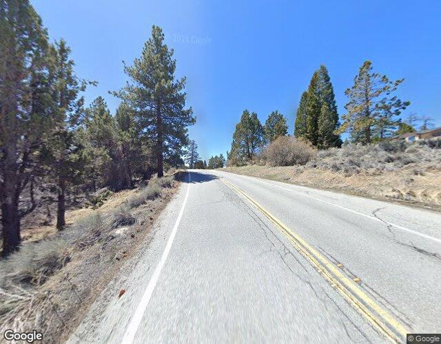
Applenut
6 hour(s) ago
The good news is it appears hwy 38 is now open all the time. The caveat to this is there's 30 min. flagging operations Mon-Fri 8-5. We got caught in one by South Fork yesterday that lasted about that long. Understandable, as they're doing massive, massive grading operations on the hillsides with dozens of heavy bulldozers, excavators, mine dump trucks, and a train of 20 or so dirt hauling trucks. Sand and gravel all over the roads, not recommended for motorcycles. You're a fool if you drive fast through there, big forklifts with their tines right at windshield level pulling out, rocks and logs rolling across the road, and you'll pass someone just to get stuck at a flag. Beautiful drive and the grading and engineering is fascinating, but hope you're not in a hurry. Work stops evenings and weekends, but don't expect the road to be pristine, still watch for rocks and sand.

SCM ALERT🚨
17 hour(s) ago
HAPPY BIRTHDAY TO:
rebug
RockinBarBell
Have a great day from all of us at SCM!

doo·hick·ey
18 hour(s) ago
Next viewing chance will be this Tues, launch window opens 7:00 PM

Then again on the 21st also 7pm >!<

⚡WX ALERT⚡
20 hour(s) ago
Welp, Space X launch now bumped to 10:03 PM!

⚡WX ALERT⚡
21 hour(s) ago
Launch moved to 8:58 PM! 🚀

Walkermuggz
22 hour(s) ago
Pretty cloudy over here Wx Alert. Going to vista point, probably wouldn’t be a clear shot.

⚡WX ALERT⚡
22 hour(s) ago
Space X launch still on for tonight at 8:09 PM. May be visible in our western sky, depending on cloud cover.
[Click Here]

Trail Rider
22 hour(s) ago
Yeaaa! The astronauts are back!

Trail Rider
22 hour(s) ago
Watchful, thanks for the good news about Ms Van Poppel

Walkermuggz
24 hour(s) ago
Integrity splash down! Perfect…welcome back crew. 😁🤙🏽

marshall
1 day(s) ago
watchful,
Thank you. Thank Jesus!!!!!

echofox
1 day(s) ago
watchful,Great news!


Latest Forum Posts
Posted by SCM ALERT🚨 in ROAD CONDITIONS
CALTRANS UPDATE: SBCO: State Route 173 in Lake Arrowhead is closed from Village (Apr 06 26: 06:54pm)

Posted by SCM ALERT🚨 in ROAD CONDITIONS
CALTRANS UPDATE: SBCO: NB SR-330 closed at Highland Avenue and SB SR-330 closed (Apr 04 26: 07:24pm)

Posted by SCM ALERT🚨 in ROAD CONDITIONS
CALTRANS UPDATE: @CityofBBL #caltrans8 @SBCoPublicWorks @SBCounty @CHPArrowhead (Apr 01 26: 03:39pm)

Posted by SCM ALERT🚨 in ROAD CONDITIONS
CALTRANS UPDATE: SBCO: Heads up, Big Bear motorists A new drainage and safety i (Apr 01 26: 03:38pm)

Posted by SCM ALERT🚨 in ROAD CONDITIONS
CALTRANS UPDATE: SBCO:📢Big improvements on SR-38 in Redlands are on the way! Wa (Mar 26 26: 08:34am)

Posted by SCM ALERT🚨 in ROAD CONDITIONS
CALTRANS UPDATE: SBCO:🚨New Project on SR-18 Coming Soon🚨Stay informed on upcomi (Mar 24 26: 11:03am)

Posted by SCM ALERT🚨 in ROAD CONDITIONS
CALTRANS UPDATE: RIVCO: NB/SB SR-111 full closure between Bay Drive and Parksid (Mar 18 26: 09:08pm)

Posted by SCM ALERT🚨 in ROAD CONDITIONS
CALTRANS UPDATE: SBCO: EB SR-38 full closure from Bryant St. to Thurman Flats i (Mar 16 26: 03:29pm)


(C)2002-2025 Socalmountains.com
All Rights Reserved
Privacy Policy Terms of Service
Contact Us

{THEMEDISCLAIMER}