Current Weather @ 6:35 PM Clear skies Temp 29.3º Humidity 60% Winds ENE 0.0mph Max Gust 8.1mph
Todays Extremes High 44.3º Low 22.7º Rain 0.00" Rain Rate 0.000" per hr Snow 0.00" Season 6"
ALERTS (click alert for more info)

(Click alert for more info)
Welcome
Username:

Password:


Remember me

[ ]
[ ]
SUPPORT SCM!
Support SCM by making a single or recurring donation.


ROADS AND TRAFFIC
Updated: 06:30 PM v2.5
Run Spr to Highland  (330): 25 mins  
Highland to Run Spr  (330): 21 mins  
Big Bear to Run Spr    (18): 29 mins  
Run Spr to Big Bear    (18): 23 mins  
Big Bear to Redlands  (38): 65 mins  
Redlands to Big Bear  (38): 65 mins  
Big Bear to Lucerne    (18): 36 mins  
Lucerne to Big Bear    (18): 36 mins  
=Light  =Moderate  =Heavy Traffic
Road Conditions Page: Click Here
Online
Guests: 341, Members: 4 ...
DesertHopper
REBB
Karriest
Splinter

most ever online: 3772
(Members: 27, Guests: 3745) on Feb 26 23: 07:51am

Members: 9508
Newest member: Cccr
Member's Birthdays:

Upcoming Birthdays:
Dec 29 ROCK
Dec 29 corky
Dec 29 Pappabear
Dec 29 akagarcia
Dec 29 OrangeCrush
Dec 29 Casadelgado
LATEST INCIDENTS (DETAIL)


NO MAP IS AVAILABLE NOT ENOUGH INFORMATION

SUN DEC 28, 2025, 9:30 AM
REPORTED FIRE
YUCAIPA
HIGHWAY 38 at BRYANT ST
9:29AM [13] 75-104 CPYS BT INFO - UNLESS REQUEST BY FIRE [SHARED]
9:25AM [2] SMOKE SEEN / NEGATIVE FLAMES
9:25AM [10] [APPENDED, 09:29:24] [4] POSSIBLE BRUSH ON FIRE // TRANSFERRED TO COMM CNT

UNITS RESPONDING: CHP (CHP)
NOTES:
FIRE-REPORT OF FIRE HIGHWAY 38 / BRYANT ST
WEATHER AT INCIDENT: 52 DEGREES WITH 41% HUMIDITY. WINDS E AT 1 MPH. PRECIP: NONE
(SOCALMOUNTAINS.COM CAD v13.1)


PHOTOS & MAPS:  

SCM Incident Map
Incident Street View
SCM Incident Map
Incident Satellite Map


INCIDENT UPDATES: 0   


SCANNER AUDIO IS NOT AVAILABLE FROM THIS HOUR


Chatbox
You must be logged in to post comments on this site - please either log in or if you are not registered click here to signup


echofox
23 minute(s) ago
Gabion?

holeinbow
58 minute(s) ago
Well rats on the scrub. I hear rain coming in for new years so keep scrubbing that rocket, wouldnt want it to get dirty...

holeinbow
1 hour(s) ago
Theres quite a few gabion type structures up the metcalf drainage along 2n10, they form little dams and make for summer ponds, metcalf creek drains out of cedar lake 24/7/365. The only thing missing from that whole aquatic ecosystem is ...
Fissh. It would be so easy to remove obstacles and create fissh ladders, the area could be positively infested with trouties. What stands in the way? The powers that be, the sbnf, and cadfw...

⚡WX ALERT⚡
1 hour(s) ago
Launch canceled. Going for Tuesday now.

⚡WX ALERT⚡
2 hour(s) ago
One hour to 2nd SpaceX launch attempt! All things a GO at this time.

SCM ALERT🚨
2 hour(s) ago
[UPDATE]
REPORTED FIRE in MOUNTAIN HOME VILLAGE
False Alarm, Cancel
DETAILS: [Click Here]

McToddy
2 hour(s) ago
Thx for the explanation Spectr17

SCM ALERT🚨
3 hour(s) ago
[CHP DISPATCH] MOUNTAIN HOME VILLAGE - REPORTED FIRE HIGHWAY 38 / THURMAN FLATS PICNIC AREA
UPDATES: [Click Here]
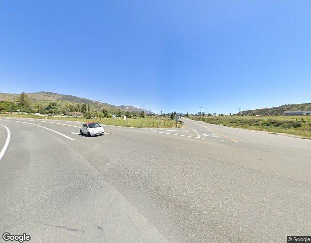
spectr17
3 hour(s) ago
On fhe repair at hwy 38 at Foresee Ck. The pic of the wall that looks like it has steps. Its a gabion wall.

i had to look up gabion wall.

From google

A gabion wall is a retaining structure made from wire mesh baskets (cages) filled with rocks, concrete, or other materials, creating a strong, permeable, and flexible barrier used for erosion control, landscaping, and military defense.

These walls allow water to drain freely, preventing hydrostatic pressure, and can move with the earth, unlike rigid concrete, making them durable for freeze-thaw cycles. They are popular in landscape design for their natural look but can also be bulky and host vegetation.

From one of the workers.

The ones here, used on the 38, are 18”x18” tiers with 3’ of geogrid and filter fabric into the slope at each step. These cages here are filled with rock.

SCM ALERT🚨
8 hour(s) ago
[INCIDENT DISPATCH]
TU /TRAFFIC COLLISION WITH UNKNOWN INJURIES IN BIG BEAR LAKE - NB HWY MM BIG BEAR LAKE
DETAILS: [Click Here]

SCM ALERT🚨
9 hour(s) ago
[CHP DISPATCH] YUCAIPA - REPORTED FIRE HIGHWAY 38 / BRYANT ST
UPDATES: [Click Here]

SCM ALERT🚨
11 hour(s) ago
[CHP DISPATCH] RUNNING SPRINGS - ROCKS IN ROADWAY 3900 HIGHWAY 18 S SBD 39.00
UPDATES: [Click Here]

SCM ALERT🚨
19 hour(s) ago
HAPPY BIRTHDAY TO:
GlobalMonKahuna
Codger
MountainGigi
Have a great day from all of us at SCM!

SCM ALERT🚨
19 hour(s) ago
[INCIDENT DISPATCH]
ASLT /ASSAULT IN SUGARLOAF - *(CLEAR) / CEDAR AVE SUGARLOAF
DETAILS: [Click Here]

SCM ALERT🚨
21 hour(s) ago
Thx McToddy!
we will get em tomorrow!


Latest Forum Posts
Posted by SCM ALERT🚨 in ROAD CONDITIONS
CALTRANS UPDATE: SR-138 lanes between Wagon Train Road and junction SR-173 are (Dec 26 25: 02:24am)

Posted by SCM ALERT🚨 in ROAD CONDITIONS
CALTRANS UPDATE: SBCO: EB/WB SR-138 emergency closures between junction SR-2 an (Dec 25 25: 05:29pm)

Posted by SCM ALERT🚨 in ROAD CONDITIONS
CALTRANS UPDATE: SBCO: EB/WB SR-18 emergency closures between Sheep Creek Rd th (Dec 25 25: 02:29pm)

Posted by SCM ALERT🚨 in ROAD CONDITIONS
CALTRANS UPDATE: SBCO: EB/WB SR-138 emergency closure between Old Mill Road and (Dec 24 25: 03:14pm)

Posted by SCM ALERT🚨 in ROAD CONDITIONS
CALTRANS UPDATE: SBCO: EB/WB SR-138 emergency closure between junction I-15 and (Dec 24 25: 03:14pm)

Posted by SCM ALERT🚨 in ROAD CONDITIONS
CALTRANS UPDATE: SBCO: EB/WB SR-138 emergency closure between  I-15 Interchange (Dec 24 25: 10:59am)

Posted by SCM ALERT🚨 in ROAD CONDITIONS
CALTRANS UPDATE: SBCO: EB/WB SR-18 all lanes closed @ Sheep Creek Road due to f (Dec 24 25: 10:44am)

Posted by SCM ALERT🚨 in ROAD CONDITIONS
CALTRANS UPDATE: SBCO: EB/WB SR-2 emergency closure between SR-138 and Cardinal (Dec 24 25: 10:24am)


(C)2002-2025 Socalmountains.com
All Rights Reserved
Privacy Policy Terms of Service
Contact Us

{THEMEDISCLAIMER}