Current Weather @ 11:15 PM clear Temp 39.7º Humidity 73% Winds W 14.0mph Max Gust 42.6mph
Todays Extremes High 50.2º Low 39.7º Rain 1.63" Rain Rate 0.000" per hr Snow 0.00" Season 5"
ALERTS (click alert for more info)

(Click alert for more info)
Welcome
Username:

Password:


Remember me

[ ]
[ ]
SUPPORT SCM!
Support SCM by making a single or recurring donation.


ROADS AND TRAFFIC
Updated: 11:00 PM v2.5
Run Spr to Highland  (330): 21 mins  
Highland to Run Spr  (330): 21 mins  
Big Bear to Run Spr    (18): 22 mins  
Run Spr to Big Bear    (18): 23 mins  
Big Bear to Redlands  (38): 66 mins  
Redlands to Big Bear  (38): 65 mins  
Big Bear to Lucerne    (18): 34 mins  
Lucerne to Big Bear    (18): 36 mins  
=Light  =Moderate  =Heavy Traffic
Road Conditions Page: Click Here
Online
Guests: 436, Members: 3 ...
bunnysmom
IC
Jrunningsprings

most ever online: 3772
(Members: 27, Guests: 3745) on Feb 26 23: 07:51am

Members: 9504
Newest member: Solrik
Member's Birthdays:
Happy Birthday to:

Birthday Cake
SoCalNews


Upcoming Birthdays:
Dec 25 angel
Dec 25 Chrissy
Dec 25 Desert Way Jay
Dec 26 Eric_rs
Dec 26 gratitude dude
Dec 26 Troll
LATEST INCIDENTS (DETAIL)


NO MAP IS AVAILABLE NOT ENOUGH INFORMATION

WED DEC 24, 2025, 9:35 PM
TRAFFIC ACCIDENT
BIG BEAR LAKE
4100 BLOCK OF HIGHWAY 18 N SBD 41.60
9:29PM [43] B101-021 W FIRE PASSING SNOW VALLEY NOW [SHARED]
9:22PM [30] [APPENDED, 21:22:34] [4] WHITE VAN OVER RIGHT HAND SHOULDER GUARDRAIL
9:17PM [21] PANORAMA ADVISED VIA LL UNABLE TO MAKE ESTIMATED TIME OF ARRIVAL [SHARED]
9:15PM [19] CHP UNIT 101-32 REQUEST TOW TRUCK REQUIRED [SHARED]
9:12PM [17] MESSAGE DELIVERED TO SBCOMM [SHARED]
9:12PM [16] REPORTING PARTY ADVISE UPBOUND LANES BLOCKED // RPAID SHOWING NEAR MILE MARKER 41.7 [SHARED]
9:11PM [15] [NOTIFICATION] [CHP]-PROBLEM CHANGED FROM ACCIDENT NO DETAILS COLLISION-UNKN INJURY TO AMBULANCE ENROUTE COLLISION-AMBULANCE EN ROUTE BY CHP [SHARED]
9:11PM [11] BUS VS GR [SHARED]
9:10PM [6] [NOTIFICATION] [CHP]-PROBLEM CHANGED FROM TRAFFIC HAZARD-TRAFFIC HAZARD TO ACCIDENT NO DETAILS COLLISION-UNKN INJURY BY CHP
9:10PM [5] TRAFFIC HAZARD ROCKS IN THE AREA AS WELL

UNITS RESPONDING: CHP (CHP)
NOTES:
TRAFFIC ACCIDENT FIRE DEPARTMENT IS ENROUTE COLLISION-1141 EN ROUTE 4160 HIGHWAY 18 N SBD 41.60
**ALERT** REPORTED ROCKS IN ROADWAY
**ALERT** ROADWAY POSSIBLY BLOCKED
**CAUTION** FIRE DEPARTMENT IS RESPONDING TO THIS INCIDENT
WEATHER AT INCIDENT: 38 DEGREES WITH 92% HUMIDITY. WINDS WSW AT 9 MPH. PRECIP: NONE
(SOCALMOUNTAINS.COM CAD v13.1)


PHOTOS & MAPS:  

SCM Incident Map
Incident Street View
SCM Incident Map
Incident Satellite Map


INCIDENT UPDATES: 0   


SCANNER AUDIO IS NOT AVAILABLE FROM THIS HOUR


Chatbox
You must be logged in to post comments on this site - please either log in or if you are not registered click here to signup
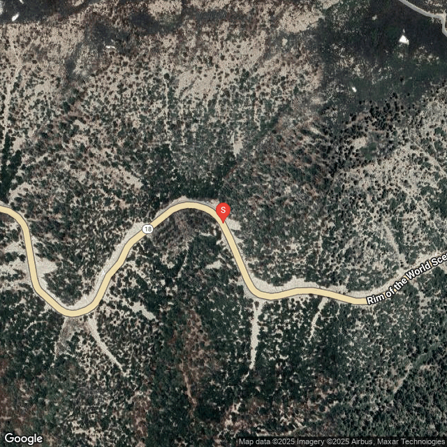

SCM ALERT🚨
2 hour(s) ago
Arrowbear, TC, Arrowbear Valley, responding with Medic Engine 96 to a vehicle versus the guardrail, Highway 18 at mile marker 41, at 2121

SCM ALERT🚨
2 hour(s) ago
[INCIDENT DISPATCH]
TU /TRAFFIC COLLISION WITH UNKNOWN INJURIES IN BIG BEAR LAKE - SB HWY MM BIG BEAR LAKE
DETAILS: [Click Here]

mountainart
4 hour(s) ago
and the town power lines got washed out

mountainart
4 hour(s) ago
my relative lives in Wrightwood, says lots of houses flooded with swift water and rock/debris flows, they are stuck there with no way out of wrightwood possible due to road/hwy2 washed out

SCM ALERT🚨
4 hour(s) ago
[CHP DISPATCH] RUNNING SPRINGS - ROCKS IN ROADWAY 3700 HIGHWAY 330 S SBD 37.00
UPDATES: [Click Here]

Jellylorum
5 hour(s) ago
Drunkpirate - check Caltrans QuickMaps. It is indicating both the 18 and 138 are CLOSED between the 18/138 Jct and Adelanto.

You can see more details on QuickMaps if you go to Options and check off every box.

Polar 🌌rbit
5 hour(s) ago
Is Summit even going to try the normal New Year Eve light show?

Drunkpirate
5 hour(s) ago
Anyone driven from 14 to the 18 into victorville recently that can tell me what kind of closures I'm in for on pearblossom/138 through to Lucerne?

SCM ALERT🚨
6 hour(s) ago
SR18 ARCTIC CIRCLE
Between Snow Valley and the Big Bear Dam.
Major Delays due to Rock/Mud slides...

SCM ALERT🚨
6 hour(s) ago
RADAR is lightening up over the mountains as stuff moves east.... Looks like we did okay east of the Cajon Pass. West of the Cajon Pass (Wrightwood, etc) really got hit hard as most of you have seen.

SCM ALERT🚨
6 hour(s) ago
[CHP DISPATCH] CRESTLINE - CLOSURE OF A ROAD SR138 / OLD MILL RD
UPDATES: [Click Here]

SCM ALERT🚨
6 hour(s) ago
SR18 ARCTIC CIRCLE
SLIDE ON ROADWAY
REPORTING PARTY ONLY VEHICLE STUCK
4:52PM [4] VEHICLES BEHIND HER WILL NOT BACK UP SO SHE CAN GET OUT
4:52PM [3] REPORTING PARTY STUCK IN MIDDLE OF ROCK SLIDE -- 3 BOULDERS SURROUNDING HER VEHICLE

SCM ALERT🚨
7 hour(s) ago
TRAFFIC HAZARD
SAN BERNARDINO
3525 HIGHWAY 330 S SBD 35.30
4:41PM [1] BOULDER IN DOWNBOUND LANE

Van
8 hour(s) ago
here comes some strong wind gusts. 2.8" of rain and temp has risen a little now 43 degrees

SCM ALERT🚨
8 hour(s) ago
EVACUATION ORDER (SBC SHERIFF)‼️
The community of Lytle Creek is under an evacuation order.
More Info: [Click Here]


Latest Forum Posts
Posted by SCM ALERT🚨 in ROAD CONDITIONS
CALTRANS UPDATE: SBCO: EB/WB SR-138 emergency closure between Old Mill Road and (Dec 24 25: 03:14pm)

Posted by SCM ALERT🚨 in ROAD CONDITIONS
CALTRANS UPDATE: SBCO: EB/WB SR-138 emergency closure between junction I-15 and (Dec 24 25: 03:14pm)

Posted by SCM ALERT🚨 in ROAD CONDITIONS
CALTRANS UPDATE: SBCO: EB/WB SR-138 emergency closure between  I-15 Interchange (Dec 24 25: 10:59am)

Posted by SCM ALERT🚨 in ROAD CONDITIONS
CALTRANS UPDATE: SBCO: EB/WB SR-18 all lanes closed @ Sheep Creek Road due to f (Dec 24 25: 10:44am)

Posted by SCM ALERT🚨 in ROAD CONDITIONS
CALTRANS UPDATE: SBCO: EB/WB SR-2 emergency closure between SR-138 and Cardinal (Dec 24 25: 10:24am)

Posted by SCM ALERT🚨 in ROAD CONDITIONS
CALTRANS UPDATE: SBCO: NB I-15 @ SR-138 (Cajon Junction) emergency closure due (Dec 24 25: 08:44am)

Posted by SCM ALERT🚨 in ROAD CONDITIONS
CALTRANS UPDATE: ✨ A Christmas Miracle, some may say — powered by dedication, t (Dec 22 25: 04:34pm)

Posted by Polar 🌌rbit in GENERAL DISCUSSION
I'm stuck with Fair plan as well. The rest is through Foremost which is a Farmer (Dec 20 25: 08:29am)


(C)2002-2025 Socalmountains.com
All Rights Reserved
Privacy Policy Terms of Service
Contact Us

{THEMEDISCLAIMER}